Special Weather Statement
National Weather Service Portland OR
1148 AM PDT Mon Sep 13 2021
…COOL AND WET FALL-LIKE WEATHER WILL ARRIVE LATER THIS WEEK…
The weather pattern will change later this week as a series of strong, wet cold fronts will bring an end to this long dry and hot summer.
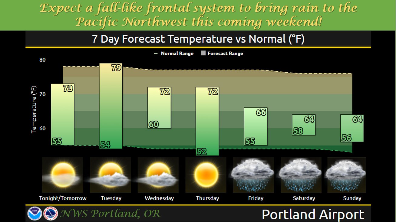
Overnight temperatures will cool into the lower to middle 40s Wednesday night, with some of our more exposed and traditionally cooler locales dropping down into the 30s. With the potential of frost in outlying rural areas, consider taking time and precautions to protect any temperature sensitive plants. Afternoon high temperatures will be in the 70s through Thursday, then cool to the 60s for Friday into this weekend.
A strong cold front will push into the region Friday and Friday night, bringing the first significant widespread rain to the region since last spring. Exact amounts are still being ironed out, but there is increasing confidence for at least a half inch or more for the interior lowlands, with one to two inches for the Willapa Hills, Coast Range and the Cascades. Afterwards, cool showery weather is expected for Saturday into Sunday.
With the expected rainfall, any clogged drains or gutters could easily overfill. With the dry weather through Thursday, consider checking outdoor drains, roof gutters, and other areas with poor drainage and clearing out the dead leaves and debris.
Also, there areas around in the past burned-over areas, such as the Santiam Canyon and the upper McKenzie River Valley, could see
For the latest forecasts and weather observations, visit www.weather.gov/portland


