By Gordon McCraw
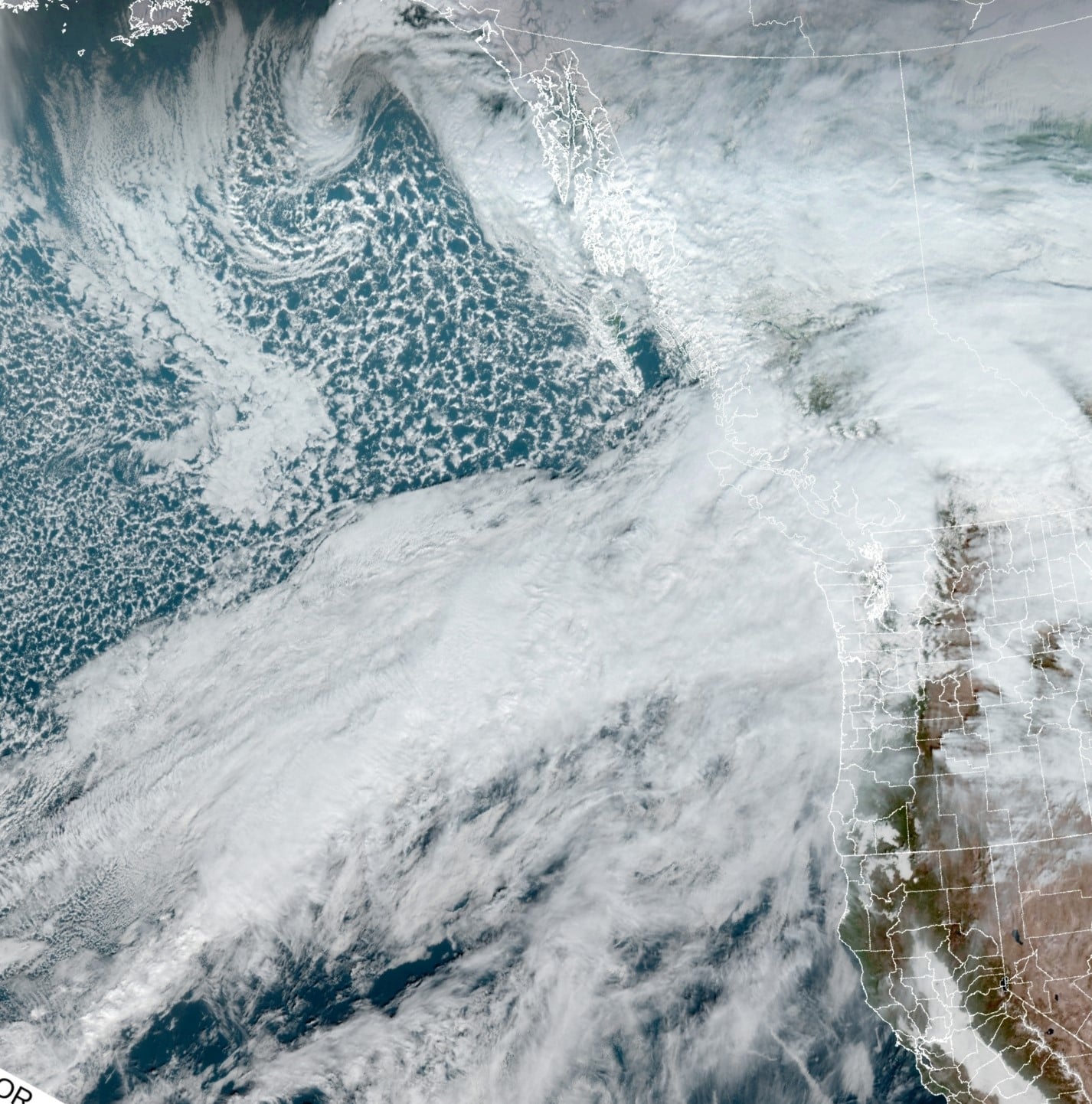
There was another atmospheric river moving into the coast this morning as you can see in the satellite picture. The good news, as you can see, it aimed at Vancouver Island this time. However, the system will eventually slide southward tomorrow giving us some strong southerly coastal winds, 20-30 gusting to 50-60 along the beaches, especially from Tillamook northward, 20-25 gusting to 40 inland. The rain tonight will likely be off and on light rain then tomorrow as the cold front drops southward the rain picks up giving us another 1-2” of rain along with some gusty winds as the front itself moves thru. For now, it appears the only river to go above flood level tomorrow will be the Grays River in Washington. It appears it may just get just above Flood Stage tomorrow afternoon or evening. While we will also get a period of heavy rain, it will be moving rather quickly so we only see moderate to occasionally heavy rain for 2-4 hours. We will see sharp river rises but river flooding in Tillamook County is unlikely unless the system unexpectedly slows or stalls. The main element with this one, for us anyway, should only be the winds.
The other factor with this front is the colder temperatures following the front. Snow levels will drop to maybe the higher peak of the Coast Range, 2000-3000’ in the Cascades. This means, as we usually see some past frontal showers, there could be some snow accumulation in the higher Coast Range mountains though the rain and showers will be easing after midnight. Our temperatures, which will be in the low to mid 60s today and low 50s tonight, will be falling behind the front tomorrow, falling into the upper 40s by tomorrow evening and down to around 40 tomorrow night.


