By Gordon McCraw, GAM Weather
Wednesday, February 10, 2021 at 2:00pm
Today is the last of the “nice” days before the pattern changes. It looks like we will have a prolonged period of COLD starting tomorrow, Thursday Feb. 11 and lasting thru the weekend before we have a slow warming trend. It also looks like we have two events, one for Thursday into Friday, Feb. 12 and another Friday night into Saturday, Feb. 13.
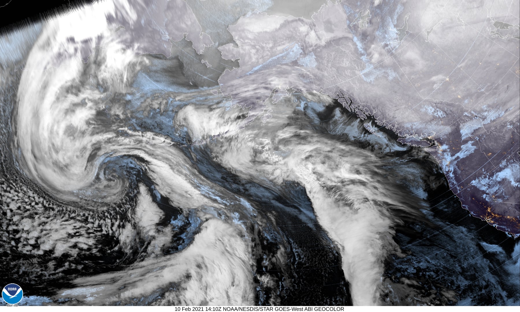
Currently (system #1) we have a front approaching from the west that will push in moisture late tonight into tomorrow morning. We will also have very cold air spilling into the valley through the Gorge as the winds shift and become easterly and gusty tomorrow. Initially, for us coastal folks, the precipitation will be rain with tomorrow’s highs in the mid 40s, the east winds becoming 25-20 gusting to 30-35 into Astoria and across the Coast Range Passes. Tomorrow night is where things could get interesting. The combination of the cold east winds and the loss of daytime heating will allow the temperatures to drop pretty quickly. With warmer air over top of the denser cold air at the surface, freezing rain is likely, first up north towards Astoria around 7:00-9:00pm, then progressing southward towards northern Tillamook County and across the Hwy 6 pass around 11:00pm -2:00am. The low temperature along the coast for tomorrow night is around 33 so the greatest chance of low level freezing rain or a snow/rain mix in and around Tillamook is just before until just after daybreak Friday Feb. 12. The farther south you go, the chances of frozen precipitation lessens as the temperatures are a little warmer.
Friday, Feb. 12, we warm up to around 41 with the snow level up around 2000’ which means any precipitation will fall as rain after midmorning in all locations. The bad thing is the colder air will have spilled all the way to the coast by Friday night so temperatures will fall into the low 30s after the sun goes down and all the moisture on the ground will freeze and any precipitation has the potential to be freezing rain by later that night thru Saturday morning with another front (system #2) going thru that enhances the rain threat. The early morning low around 27. The Coast Range passes could see freezing rain then some snow as the snow level will be falling to near 1500’ early morning.
Saturday, Feb. 13, the high will only be in the upper 30s to low 40s so again, anything frozen on the ground slowly melts as the temperatures and the snow levels rise with daytime heating, the chance of precipitation still around 80%. Saturday night the low level temperatures are again expected to fall to or below freezing and the snow level lowers to around 1500’ so the passes have another chance of snow, on top of the refreezing moistures left on the surfaces, lows near 30.
On Sunday, February 14th (Happy Valentine’s Day) things start to slowly moderate. Still a chance of rain each day with daytime highs around 48, nighttime lows near 36.
Remember, travel at night, and across the higher passes could be very difficult and very hazardous at times for the next few days. If you have business over in the valley, check before you go as their weather is projected to be worse than ours with increased icing and snow issues. Remember to, with icing events, especially up over the passes, the extra ice weight can cause tree limbs to break off and have even caused downed power lines from the weight. Now is a good time to prepare for these conditions. Gas up the cars, get enough food so you can stay home thru the weekend, check on your elderly relatives, and don’t forget about you pets!
Warming Center Opening – Thursday Feb. 11, Friday, Feb. 12, Saturday, Feb. 13 and Sunday Feb. 14
I am pleased to share that the Tillamook Warming center will be open Thursday February 11th, Friday February 12th, Saturday February 13th, and Sunday February 14th. The center is located in ROOM #125 at the Western Royal Inn, 1125 N. Main Street, Hwy 101 in Tillamook. The open hours are from 8 pm to 7:30 am. PLEASE post this opening, see in the attachment, and share with anyone who could benefit from a safe & warm place to stay.
Gordon McCraw


