Menu
  • Home
  • Breaking News
  • Feature
    • Arts
    • Astrology
    • Business
    • Community
    • Employment
    • Event Stories
    • From the Pioneer
    • Government
    • Letters to the Editor
    • Non Profit News
    • Obituary
    • Public Safety
    • Podcast Interview Articles
    • Pioneer Pulse Podcast: Politics, Palette, and Planet – the Playlist
  • Weather
  • Guest Column
    • Perspectives
    • Don Backman Photos
    • Ardent Gourmet
    • Kitchen Maven
    • I’ve been thinking
    • Jim Heffernan
    • The Littoral Life
    • Neal Lemery
    • View From Here
    • Virginia Carrell Prowell
    • Words of Wisdom
  • Things to do
    • Calendar
    • Tillamook County Parks
    • Tillamook County Hikes
    • Whale Watching
    • Tillamook County Library
    • SOS Community Calendar
  • About
    • Contribute
    • Advertise
    • Subscribe
    • Opt-out preferences
  • Post Submission Test
  • Search...
Menu

GORDON’S UPDATE: Weather 1/10/23 – Hope you enjoy the dry weather today …

Posted on January 10, 2023 by Editor

Tuesday, January 10, 2023
Weather

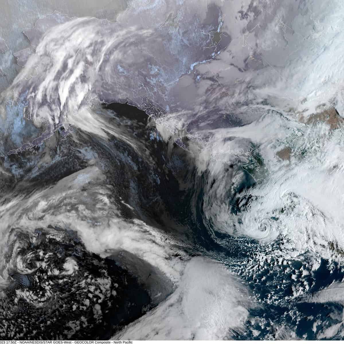
Well, yesterday’s system is now up into British Columbia while the next low pressure area in the cue is west of central Oregon and pulling some light rain or rainshowers up northward across the region. So, after a partly sunny day today, look for increasing clouds with a slight chance of some light precipitation tonight, the winds becoming southeasterly 10-15 gusting to 25, tonight’s low near 41.

Hot on the heels of tonight thru tomorrow morning’s system is yet another one approaching tomorrow bringing more clouds and some rain by the afternoon, winds becoming southeasterly 8-12 gusting to 20, highs near 54, rainy and breezy tomorrow night, winds easterly 10-15 gusting to 25, lows near 45. We can also expect the seas to build again tomorrow night into Thursday with Gale Force winds returningm offshore tomorrow afternoon. This will bring elevated seas nearshore that peak Thursday afternoon with breakers possibly reaching 25-30’. This will again give us hazardous conditions in the surf areas including all bars.

Thursday the jet stream reorients itself and the atmospheric river that has plagued California will shift northward into Oregon. Fortunately, for us, it looks to stay in the low to moderate range, bringing maybe an inch of rain into the Coast Range. All that to say, Thursday will be rainy and breezy with southerly winds 14-18 gusting to 25, highs near 56, lows near 48.

It looks like Friday on into the weekend the jet stream returns to a zonal, or west to east orientation which means a return to the low train again where more low pressure areas spin up and get pushed eastward towards the California coast then turn northward and stay just off the coast as they weaken, giving us periods of rain and winds as they past west of our area.

It appears hydrological concerns will remain low throughout this forecast period.

Featured Video

Slide Contribute SUBSCRIBE

Tillamook Weather

Tides

Tillamook County Pioneer Podcast Series

Tillamook Church Search

Cloverdale Baptist Church
Nestucca Valley Presbyterian
Tillamook Ecumenical Service

Archives

  • Home
  • EULA Privacy Policy
  • Contact
  • Opt-out preferences
  • Search...
Share on facebook
Facebook
Share on pinterest
Pinterest
Share on twitter
Twitter
Share on linkedin
Linkedin
Catherine

Recent Posts

  • TILLAMOOK COUNTY PIONEER WEEK IN REVIEW 5/8/25

    May 8, 2025
  • Exciting News for North County Recreation District – Congratulations to Barbara McCann on Retirement; Welcome New Executive Director, Justin Smith; Special Saturday Swims this Spring to Honor Legacy Pool – May 10 & June 14

    May 8, 2025
  • "I Pledge Allegiance" ... We Take an Oath

    May 8, 2025
©2025 | Theme by SuperbThemes

Manage Cookie Consent
To provide the best experiences, we use technologies like cookies to store and/or access device information. Consenting to these technologies will allow us to process data such as browsing behavior or unique IDs on this site. Not consenting or withdrawing consent, may adversely affect certain features and functions.
Functional Always active
The technical storage or access is strictly necessary for the legitimate purpose of enabling the use of a specific service explicitly requested by the subscriber or user, or for the sole purpose of carrying out the transmission of a communication over an electronic communications network.
Preferences
The technical storage or access is necessary for the legitimate purpose of storing preferences that are not requested by the subscriber or user.
Statistics
The technical storage or access that is used exclusively for statistical purposes. The technical storage or access that is used exclusively for anonymous statistical purposes. Without a subpoena, voluntary compliance on the part of your Internet Service Provider, or additional records from a third party, information stored or retrieved for this purpose alone cannot usually be used to identify you.
Marketing
The technical storage or access is required to create user profiles to send advertising, or to track the user on a website or across several websites for similar marketing purposes.
Manage options Manage services Manage {vendor_count} vendors Read more about these purposes
View preferences
{title} {title} {title}