LISTEN HERE:
By Gordon McCraw, Meteorologist for the Tillamook County Pioneer
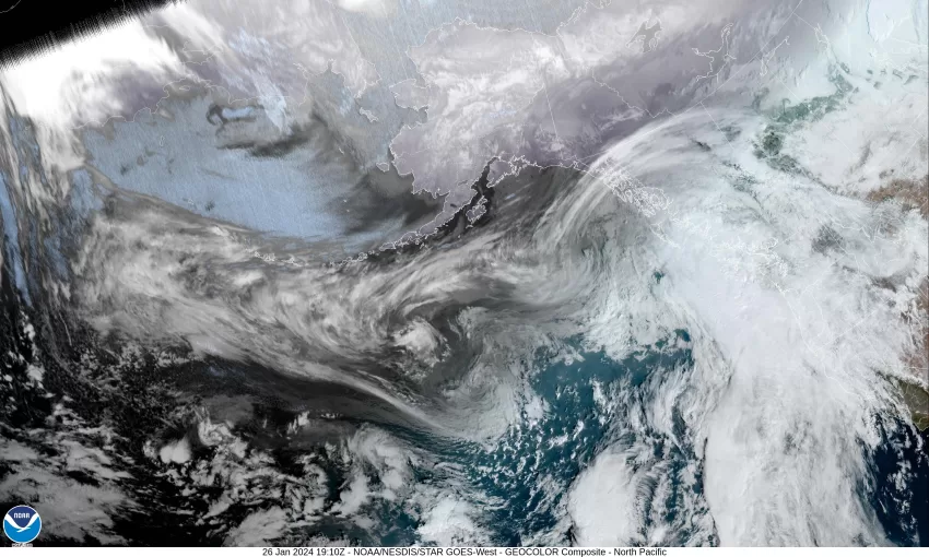
A look at the satellite picture shows lots of moisture in the Pacific that is rotating around a large low pressure area currently well west of the Washington and Vancouver Island area. This has put us under a southwesterly flow that will push the weather systems into the area today and tomorrow. First on the agenda today is a slow moving warm front that will bring rain across the area, and the rain could be moderate at times, along with some breezy winds with high temperatures in the mid 50s. The activity increases tonight and we see more rain, possibly heavy at times, along with the southerly winds increasing to 8-12 gusting to 20. With the persistent southerly winds, the low tonight only drops to near 52. Total rainfall amounts for today and tonight look to be in the order of 1-2”, maybe a little higher in the Coast Range.
The rain continues tomorrow, along with the breezy southerly winds 10-15 gusting to near 25, the afternoon high near 58, then we transition over to showers Saturday night behind the front, the shower activity will appear to ease some in the evening hours tomorrow, then another disturbance moves across and brings an increase in the activity later tomorrow night into Sunday. Winds tomorrow night southerly 8-12, the low near 54. Saturday’s rainfall will bring another 1-2” of rain across the area, and again, the Coast Range could see higher values.
We see more showers on Sunday that should be easing later that morning then diminishing in the afternoon, winds southerly 10-15 gusting to 20, and that high temperature climbs up to a balmy 63 degrees. Sunday night looks mostly cloudy and dry with a ridge over the area, with more clouds moving in later that night, the lows near 54.
I guess I should mention that the area rivers should be cresting Sunday, with the Nehalem and Wilson Rivers forecasted to be the highest, climbing to just below Action Stage Sunday morning, then cresting, and going back down.
The ridge gets pushed eastward Monday by an approaching trough of low pressure moving towards the area from the west. This gives us an increasing chance of rain in the afternoon Monday, the high still up near 62, Monday night is rainy and the low drops to near 51.
There are some model differences for Tuesday, but it looks like we transition back to showers that morning, the high near 61, then rainy and breezy Tuesday night, the low around 50. We can expect more rain and winds Wednesday along with some cooler temperatures, the high near 51, back to showers Wednesday night, lows near 52.
While we do see more rain next week, the river forecasts only show moderate rises in the Tillamook County Rivers, and all stay well below Action Stage through Friday.


