By Gordon McCraw, Meteorologist for the Tillamook County Pioneer
Monday, December 19, 2022
Weather
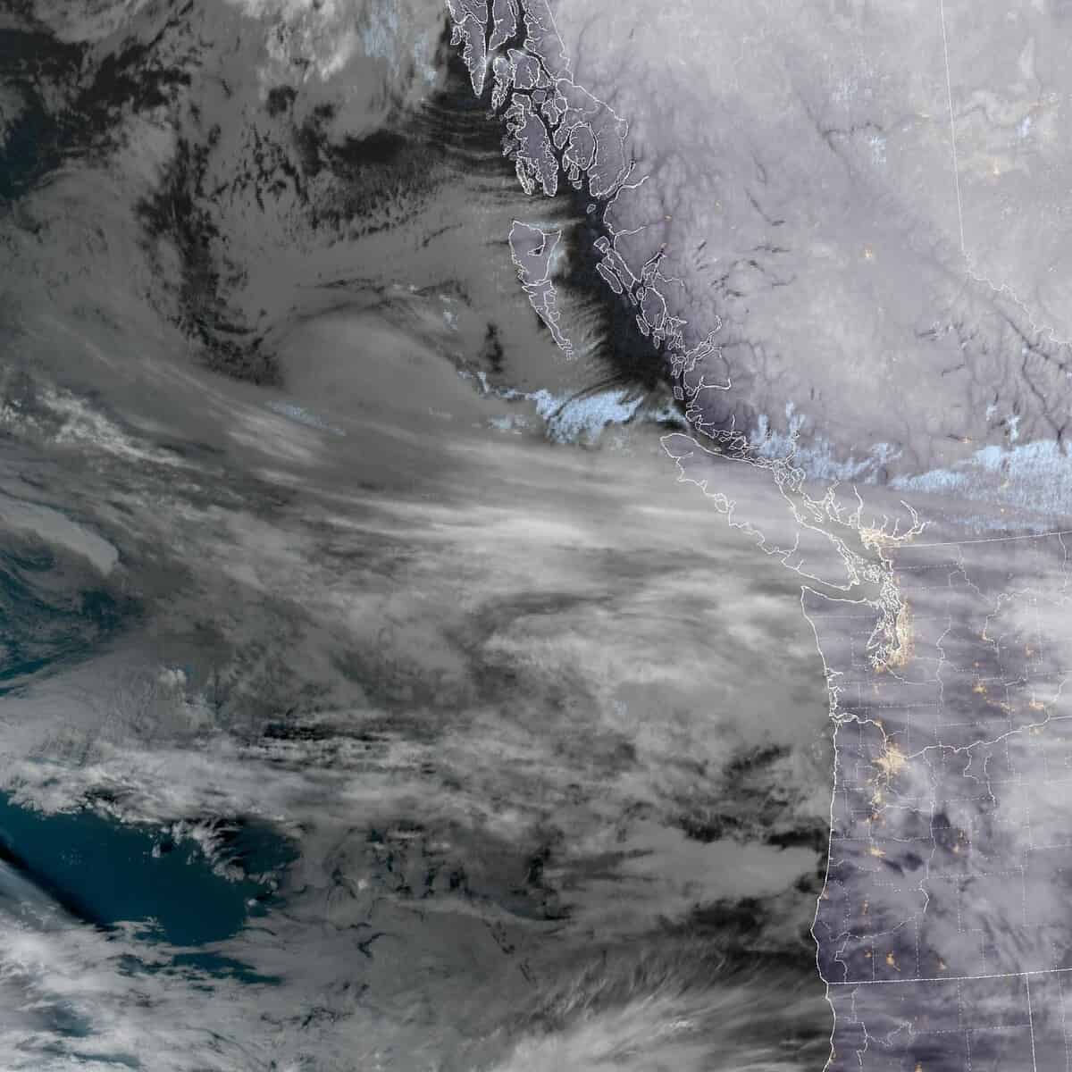
The weather models that gave us such a fit last week, about this week’s forecast, have settled down some but are still sending some mixed signals. The issue continues to be the location of an Arctic front that is forecasted to drop south towards the area and the level of intrusion of the colder air. For now, the front looks to stay further north today and tomorrow and that will lead to slightly warmer temperatures for us, which should keep the snow off the beaches. So tonight, there is a chance of rain in the early morning hours as the snow level lifts to around 2500’, winds becoming easterly 5-10, the low down to near 34.
We can expect tomorrow to be cloudy and rainy with east winds 8-12, highs near 48, a decreasing chance of rain tomorrow night with high pressure building in, east winds 4-8, lows near 33 so there could be some snow flurries in the higher Coast Range passes. I guess I should mention that a couple of the models still pushes the front further south leading to low snow levels, especially over in the valley so the snow chance is low but just not zero for tonight and tomorrow night.
The ridge moves in on Wednesday, so we dry up some with mostly cloudy skies still, with light northerly winds, highs near 42. The consensus is that the Arctic air will move in Wednesday night with some breezy east winds, pushing the lows down to around 21. The combination of the low temperatures and the gusty winds will push the windchill down into the single digits Wednesday night in the early morning hours Thursday.
This event will be a major concern for the homeless community and anyone outdoors who are not properly dressed for the dangerously cold wind chills, as well as folks without adequate heating. Frostbite and hypothermia can occur on exposed skin with wind chills this low. Bursting pipes may also be a concern on longer duration freezing events if precautions are not taken.
Thursday the forecast becomes even more uncertain. The scenario is this: we will have very cold air in place as a warmer front pushes in rain that morning so lower level snow is possible early Thursday morning. So, warmer air gets pushed in aloft but we still have those freezing temperatures at the surface, by later in the morning the falling snow melts as it falls, but upon striking the cold, below freezing surface, it refreezes, giving us a period of freezing rain sometime just before or shortly after noon. After that it transitions over to all rain, but mind you, the afternoon high on Thursday is still expected to reach only into the mid 30s. With the breezy conditions, the windchill is still expected to be in the low to mid 20s.
Thursday night with the gusty east winds still, the surface temperatures could again drop into the 20s leading to more freezing rain, leading to slick surfaces and treacherous travel conditions thru Friday morning when the winds become more southerly and pushes the temperature up to an afternoon high of near 45. The models somewhat agree on this freezing rain part of the storm event, just not on how much ice you will see, particularly Thursday night into early Friday morning.
Ho,ho, ho, Christmas Eve and Christmas Day look cloudy and rainy, but warmer, with daytime highs in the mid 50s and nighttime lows in the low 40s.
As I always say during these events, BEFORE you head out the door, look at the weather (www.weather.gov/portland) and have a look at ODOT’s www.tripcheck.com to evaluate your travel risks. We want this to be a safe, happy, and a Merry Christmas for all!
What is the difference between Windchill and Hypothermia
Windchill – Wind Chill is a term used to describe what the air temperature feels like to the human skin due to the combination of cold temperatures and winds blowing on exposed skin. In simple terms, the colder the air temperature and the higher the wind speeds the colder it will feel on your skin if you’re outside. So even if it remains the same temperature, but the wind speed increases it will actually feel colder to your skin.
So why does it feel colder if the wind speed increases but the temperature remains the same? The reason is because as wind blows across our bodies it takes the heat we naturally emit and blows it away from our bodies. The faster the wind speed the faster our body heat is taken away and the colder it feels. It is a similar process for when you blow on a hot bowl of soup to cool it down. The temperature that it feels like outside due to the air temperature and wind speed is called the “Wind Chill.”
Hypothermia – Hypothermia is caused by prolonged exposures to very cold temperatures. When exposed to cold temperatures, your body begins to lose heat faster than it’s produced. Lengthy exposures will eventually use up your body’s stored energy, which leads to lower body temperature.
Body temperature that is too low affects the brain, making the victim unable to think clearly or move well. This makes hypothermia especially dangerous, because a person may not know that it’s happening and won’t be able to do anything about it.
While hypothermia is most likely at very cold temperatures, it can occur even at cool temperatures (above 40°F) if a person becomes chilled from rain, sweat, or submersion in cold water.


