By Gordon McCraw, Meteorologist for the Tillamook County Pioneer
Tuesday, April 18, 2023
As expected, the snow level dropped to right around 1500’ early this morning, putting a dusting across the summit. The snow level lifted after the sun came up but will likely fall down close to the summit level again in the early morning hours again tonight.
The cool, showery weather will continue tonight and the upper atmospheric levels remain unstable enough that thunderstorms are still possible, especially over the coastal waters and near the Coast Range that gives it a little extra lift. Winds this evening and tonight southerly 8-12 gusting to 20, lows near 37.
Conditions change little for tomorrow, still the unstable air aloft that enhances the showers so small hail is possible as is an isolated thunderstorm. The winds tomorrow becoming more westerly 5-10, highs near 48. The activity should start to decrease later tomorrow afternoon and the thunderstorm threat diminishes, winds becoming southerly 5-10 after midnight, lows near 36, the snow level lifting some, up near 1700’.
Thursday there is a 50/50 chance of showers under mostly cloudy skies, winds southerly 5-10, the high warming to near 52, and the snow level lifts to near 3100’ by the afternoon. The models are showing another front moving across by Thursday night though there could be a timing issue as some of the models suggest sooner, some later. Having said that, Thursday night, look for showers from the front to increase, lows near 41.
After this, Friday on, a trough of low pressure will keep us under a south to southwesterly flow. Friday looks the driest, or better said…less wet with high temperatures possibly making it up around 58 degrees, a slight chance of showers Friday night, lows near 44.
As disturbances ride in on the flow, showers are likely Saturday, and we could actually hit 60 if we get enough sun, low temperatures that night around 46. Look for more showers on Sunday with a chance still on Monday, cooler with highs near 53, lows near 41.
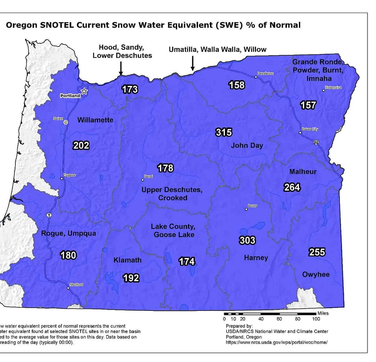
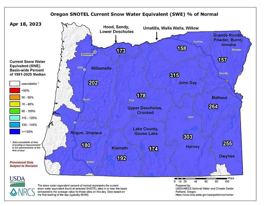
With all the snow we continue to have I thought I would look at the snowpack to see how we stand on Snow Water Equivalent % of Normal for the State. The chart for April 18th shows that overall, we are doing much better this year than in years past. As you can see, it looks like we range anywhere from 158% of normal in the Umatilla, Walla Walla area, to as high as 315% right next door to the south in the John Day area. It is safe to say that the above normal snowpack is very much helping with the drought severity, especially in western Oregon. Because of this and a wetter than normal spring, this will further improve drought conditions in the Western and Northern part of the state. The forecast for the spring/summer period is for most watersheds to see a 10-30% increase from a month ago.


