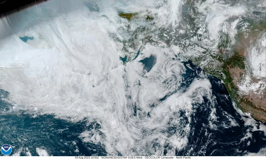
By Gordon McCraw, Meteorologist for the Tillamook County Pioneer
Boy, the northeast Pacific has become a breeding ground for low pressure areas to develop with several of them spinning around, then some of them rotate into British Columbia while others just meander about. As for us, it continues to look like the ridge of high pressure to our east will influence our weather the rest of this week. It does now look like conditions in and near the ridge will cause it to weaken some, which will affect the daily high temperatures some, especially over in the valley, this weekend. This temperature change will have less effect on us as we were being moderated already by the marine air and the onshore flow.
So, our forecast looks like this, partly cloudy skies tonight with some patchy fog possible by midnight, the breezy winds this evening becoming light and variable, lows tonight near 53.
We see a mostly sunny day again tomorrow with the winds becoming northwesterly 15-20 gusting to 30, highs near 76. We expect mostly clear skies tomorrow night, patchy fog possible, light winds again, lows near 60.
Then the weekend, Saturday rolls in with partly sunny skies, the winds becoming northwesterly 8-12 gusting to 18, highs near 75, then mostly cloudy skies Saturday night with some patchy fog possible, light winds, lows only down to near 60. Sunday returns to mostly sunny skies, the high near 75, partly cloudy Sunday night, that patchy fog possible yet again, lows near 56.
A change for next week though, the models are shifting, showing a front pushing through the area, bringing some clouds with a slight chance of showers starting Monday, still with the mostly sunny skies to start, highs near 73, then mostly cloudy skies Monday night, maybe some patchy fog again along with that slight chance of showers, lows near 57.
Things cool down some Tuesday with partly sunny skies, still the slight chance of showers, and thanks to the front, we see slightly cooler temperatures, highs near 69. Mostly cloudy skies Tuesday night, still a slight chance of post-frontal showers, and some patchy fog, lows near 53.
The National Weather Service is hinting that the 7-10 day period could bring in another heat event for the Pacific Northwest after the middle of next week. Not all the models agree but it is something to watch. There is also some concern for possible thunderstorm activity across the Cascades which would increase the wildfire concerns in that part of the state. Again, just something else to watch!


