By Gordon McCraw, Meteorologist for the Tillamook County Pioneer
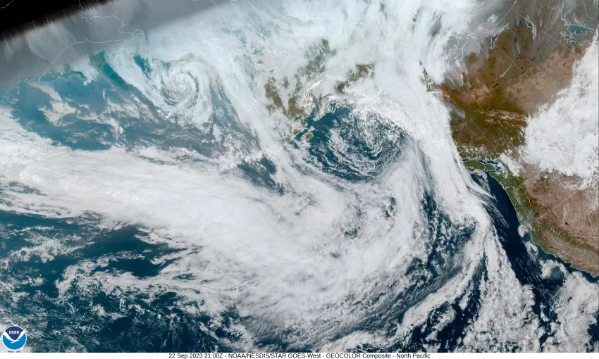
The “official” date/time of fall is today, September 22nd just before midnight, and it appears Mother Nature did get the memo. Today, we continued to have high pressure bringing us a sunny, mild day with the high up around 70ish. But the ridge is getting pushed eastward now as a trough of low pressure approaches to our west. This will give us increasing cloudiness tonight, then a slight chance of rain after midnight. The winds are becoming southeasterly 4-8 tonight, the low near 48.
It looks like a front will swing across the area tomorrow bringing us some more clouds and afternoon rain with the winds becoming southerly 5-10 gusting to 20, the high near 65, the rain eases by around midnight, the winds becoming southeasterly again 4-8, the low near 47.
By Sunday, we see the jet stream dipping southward across the region, pushing in lots of moisture, and another front with some possible breezy winds, especially at the beaches. This means Sunday is another cloudy, rainy day with the winds becoming southeasterly 10-15 gusting to 25, the high near 64, more rain with the winds becoming southerly 20-25 gusting to 30 inland, and 25-35 gusting to 45 at the beaches. There is a slight chance that a low pressure area could develop on the front and move into the area Sunday night. If this were to occur, we would see stronger winds, especially at the beaches, possibly gusting upwards of around 60-70. Something to watch for! The next question is, how much rain? It appears the coast could see 1-2” of rain with the Coast Range seeing maybe 2-3”.
Monday, we see a weak to moderate atmospheric river setting up along the coast, somewhere. The models suggest that the hose would be pointed into southern Oregon and northern California. Regardless, we see rain and rainshowers Monday with a slight chance of thunderstorms along with the windy conditions, highs near 64. The cloudy, rainy, and windy continues that night, lows near 51.
As for the rest of the forecast period, Tuesday and Wednesday look like more of the same, cloudy, rainy, and windy, highs near 62, lows near 50. The winds ease Thursday, but we still see rain in the forecast.
The only other concern would be the rivers. Looking at the current forecasts I see no hydrological issues. Obviously, this could change with future forecasts but the good news is… all the rivers are at very low levels, so while the flow rates will increase, there is lots of room, so the flooding concerns are not “zero”, they are very low at this time.


