By Meteorologist Gordon McCraw for the Tillamook County Pioneer
It is that time of year again where I throw my special darts at the weatherboard to see what the winter likely holds for the Pacific Northwest. One of the major long range climatological forecast tools is what the water temperatures in the central and eastern equatorial Pacific Ocean are doing. If those waters appear to be, and are forecasted to be, warmer than average, and the easterly winds are weaker than normal, it is called El Nino conditions. The opposite conditions are called La Nina, meaning the waters are cooler than average and the east winds are stronger.
So, what are the effects of these two different conditions? In an El Nino condition, the warmer water causes the Pacific Jet Stream to move southward and spreads further east over the winter leading to warmer and dryer conditions for the Pacific Northwest. During La Nina conditions, the Jet Stream is pushed northward, and this tends to bring heavy rains with possible flooding to the Pacific Northwest, along with cooler temperatures.
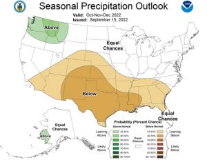
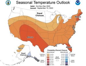
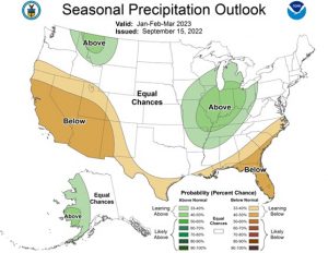
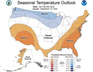
What will this season hold for us? Well, there is a 75% chance of La Nina this winter season, representing December 2022 thru February 2023, then Neutral conditions from February 2023 thru April 2023. Considering the above, this would mean if you were a betting person, you want to put more of your chips on the cooler, wetter bets. That being said, you can still see brief periods of above average temperatures, mixed in between the below normal periods, but the average of both of these would still be on the below normal side.
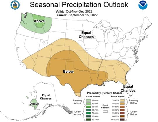
Now, the rainy part, during La Nina periods, we tend to be wetter also. The problem is, how wet? And where? We have seen periods where the heavier rains are well north of the area, and other periods where the heaviest rain remains to our south. As you know, there has been many periods where Tillamook was in the bullseye. This is what make the betting game so much fun, who will be the winner?
And what about snow? Well, there were two periods that ended up making it in the top 10 snowiest winters, that puts it at a 20% chance this year. There were also 3 years that were snow-shutouts in the last 20 years. And remember, last year was a La Nina year and Tillamook had snow!
Now, let’s recap: temperatures will likely be below average, precipitation likely above average. This means there is a higher chance of flooding this season. There is a weak chance of low elevation snow, but at the coast, that I will call about average.
So, there you have it. The reality is these are just indicators of history. As I said, you will have warm periods mixed with cold periods, the average of these will likely come out on the “below average” side. And like I used to say when I was doing hurricane forecasting, you could have a very inactive season where there is only one storm, but if that one storm goes across your house, did you have an active or inactive season?
Keeping an eye on the weather for you.
