By Gordon McCraw, Meteorologist for the Tillamook County Pioneer
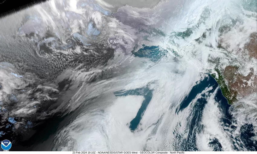
The big picture today is, we have a ridge of high pressure over the area again, and a low pressure area well off the northern California coast. The low is pushing some mainly, thin high clouds up over the area, otherwise we enjoy another fair and mild day where the afternoon temperature pushes up to near 60 after the overnight low, under the mostly clear skies, dropped to 34. We will see one more mostly clear night tonight, the winds northerly 4-8, and the low again drops to a chill 36.
The low pressure area will cut off from the jet stream tomorrow as it drifts slowly south and west, while the ridge of high pressure over our region weakens ahead of a trough of low pressure dropping southeastward from the Gulf of Alaska towards British Columbia. We will still be able to squeeze out one more mostly sunny day though with the winds becoming northwesterly 4-8, tomorrow’s high temperature not as warm, up to near 54. We see increasing clouds tomorrow night with light southerly winds, and thanks to the increased cloudiness, the low only drops to near 42.
A slight chance of rain returns early Sunday morning as the trough continues to drop to the southeast toward the area, and that rain chance increases until rain is likely later Sunday morning, the winds becoming southwesterly 8-12 gusting to 18, the high only near 51. The cold front is also moving into the area Sunday night, so we see more rain along with cooling temperatures and lowering snow levels. So, Sunday night is looking rainy with the winds becoming southwesterly 15-20 gusting to 30, gusting to near 40 at the beaches, the low dropping to near 37, and the snow level dropping to around 1700’ but could drop to around 1300’. This is low enough that the summit of Hwy 6 could be seeing a rain/snow mix overnight with a chance of patchy ice and snow in the early morning hours.
Monday is when things get a little more interesting. The front has passed though, and we transition to showers, and with the unstable, colder air aloft, we could see some brief heavier showers and possibly even a thunderstorm, still breezy, the high temperature around 45. The summit’s high temperature is forecasted to only be around 36 so they could be seeing a rain/snow mix at times. Now Sunday night the snow level drops to near 1200’ with more showers likely, still breezy, the low dropping to near 36 so it is possible that the area could see a rain/snow mix in the heavier showers in the early morning hours. This means the summit is looking at getting several inches of snow with the temperature up there in the upper 20s.
So, Tuesday starts out mostly cloudy, breezy with scattered showers, the snow level starts to climb, reaching around 1600’ later in the morning after the sun comes up, and continuing to climb in the afternoon to near 2500’, the afternoon high here near 49, the summit’s high near 39. It now looks like another system will give us an increasing chance of rain Tuesday night, along with continued breezy winds, the low only falling to near 43.
By Wednesday the models are mixed, mainly on the strength of the approaching front which will drive how much rain and wind we get. There is a slight chance that a stronger system will develop and between the heavier warm rain, and the melting snow runoff into the river basins, some of the rivers could reach bankfull or even minor flood stage. High temperatures during this period around 50, the lows in the low 40s.
Speaking of the rivers, as I always say, stay tuned as any of this can change in the future model runs. Obviously, this far out, it is best to watch the trends over what the actual river levels are forecasted to be next week.


.png)