 with slight chance of flooding!")


By Gordon McCraw, Meteorologist for the Tillamook County Pioneer
Given the very active weather expected through the weekend and into next week, I thought I would provide a weather update to my Tillamook folks. We saw a dry start to the day today as the ridge of high pressure got pushed eastward by an incoming low pressure area and its associated trough and fronts. I say fronts as it appears we will see a series of systems bringing wind and rain through the weekend and into next week.
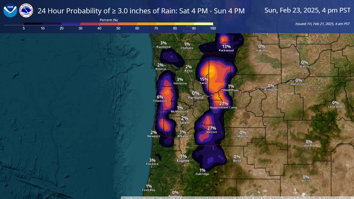
So, some mainly light rain moved in this afternoon and will persist tonight with the winds becoming southerly 5-10, the low near 47. Tomorrow, we see an atmospheric river setting up and bringing increasing rainfall rates and winds. This means we can see up to an inch of rain during the day tomorrow with the winds becoming southerly 10-15 gusting to near 30, of course a little higher along the beaches. The rain rates continue to increase tomorrow night with another 1-2” of rain expected along with the winds becoming southerly 20-25 gusting to near 40, gusting to 45-55 at the beaches.
The active weather continues Sunday with another incoming front so in comes more rain, another 1-2” or so with the increased winds, southerly 14-18 gusting to 30, maybe up to 40-50 at the beaches. The front is slow to pass which brings more rain and winds Sunday night, bringing the area another ½ -1” of rain with the breezy southerly winds still, 14-18 gusting to 30, highs Sunday near 56, lows near 47.
By Monday the models are suggesting a developing low pressure area is spinning west of the Oregon coast and pushes in more rain and winds. The models are mixed by then, but it appears, for now anyway, that the low will move northward, then move into the Vancouver Island area Monday night. This would spell showers here with possible thunderstorms for Monday night. We will also need to watch the future forecasts to see just how breezy the winds will be at the coast.
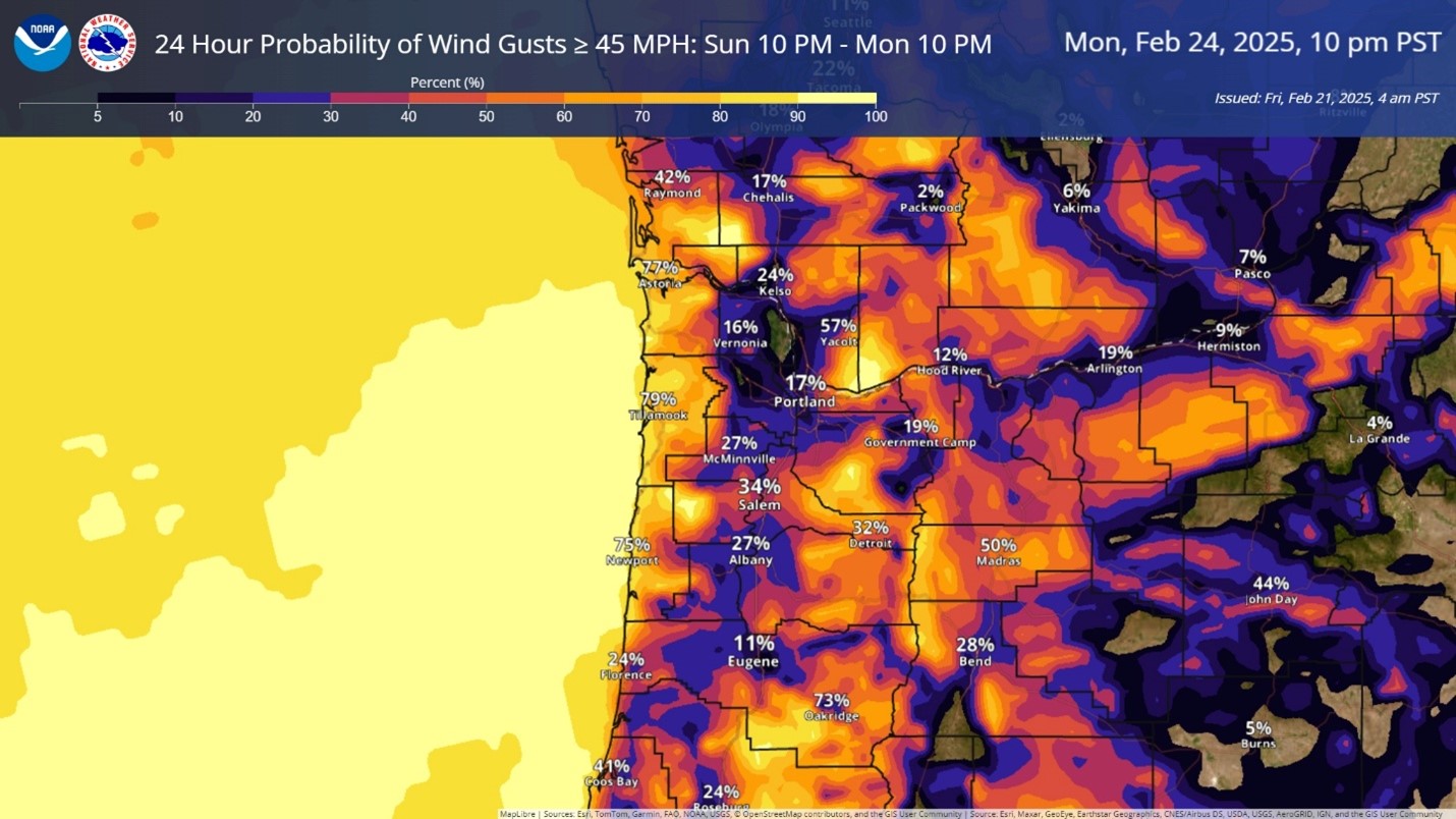
To summarize, it looks like we will see some moderate rain tomorrow, Saturday, becoming occasionally heavy starting tomorrow night, into Sunday. We are also looking at breezy conditions developing Sunday, becoming windy Sunday night with wind gusts to 55 possible at the beaches. The current river forecasts do not show the rivers increasing significantly but the River Forecast Center does say there is a 10-25% chance of minor flooding Sunday into Monday from all the rain. There is also the ever-present chance of Urban and Small Stream Flooding during prolonged heavy rain periods.
It looks like it is time to break out, dust off and review the ol’ Disaster Flood Plan. Better to have it and not need it than it is to need it and not have it! Considering the flooding chance, however small, is over the Sunday-Monday time frame, now is a good time to consider the options and prepare, just in case!