")

By Gordon McCraw, Meteorologist for the Tillamook County Pioneer
As promised, it looks like the winter weather pattern continues. We had a cold front push through Wednesday that has some unstable air riding in behind the front that gave us a chance of scattered showers with a potential of thunderstorms. These thunderstorms could bring us lightning, small hail and gusty winds as they push eastward through the region. This thunderstorm threat eased after sunset and now we are just left with a chance of showers tonight. With the overnight temperature dropping to near 36 tonight, there is a chance of some snow across the summit of Hwy 6 in early morning hours.
Friday the rain returns with another warm front sweeping through that will bring some gusty winds and rain that also pushes the snow level up around 3000’. Those winds easterly 8-12 gusting to 25, the afternoon high only near 49. We transition back to showers with possible thunderstorms after around midnight, still those breezy winds becoming westerly 10-15 gusting to near 30, the overnight low near 39.
 Saturday the shower and thunderstorm threat continues with the breezy southerly winds 10-15 gusting to 25, the high near 51. Another front brings back the rainy conditions Saturday night, the winds southwesterly 10-15 gusting to 30, the low near 39.
Sunday also looks rainy but not as breezy with southerly winds 5-10, the high near 50, lows near 38, the snow level still up around 3000’, then back to showers for Monday.
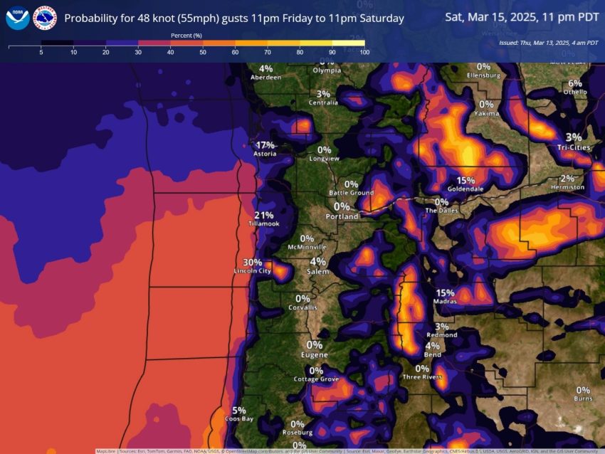
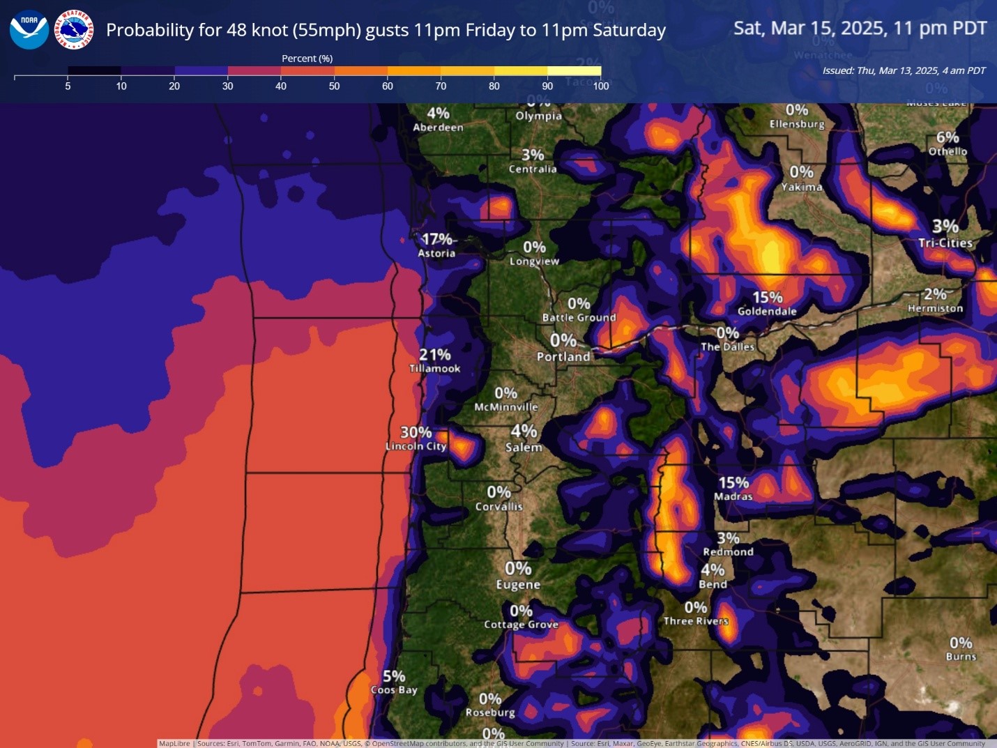
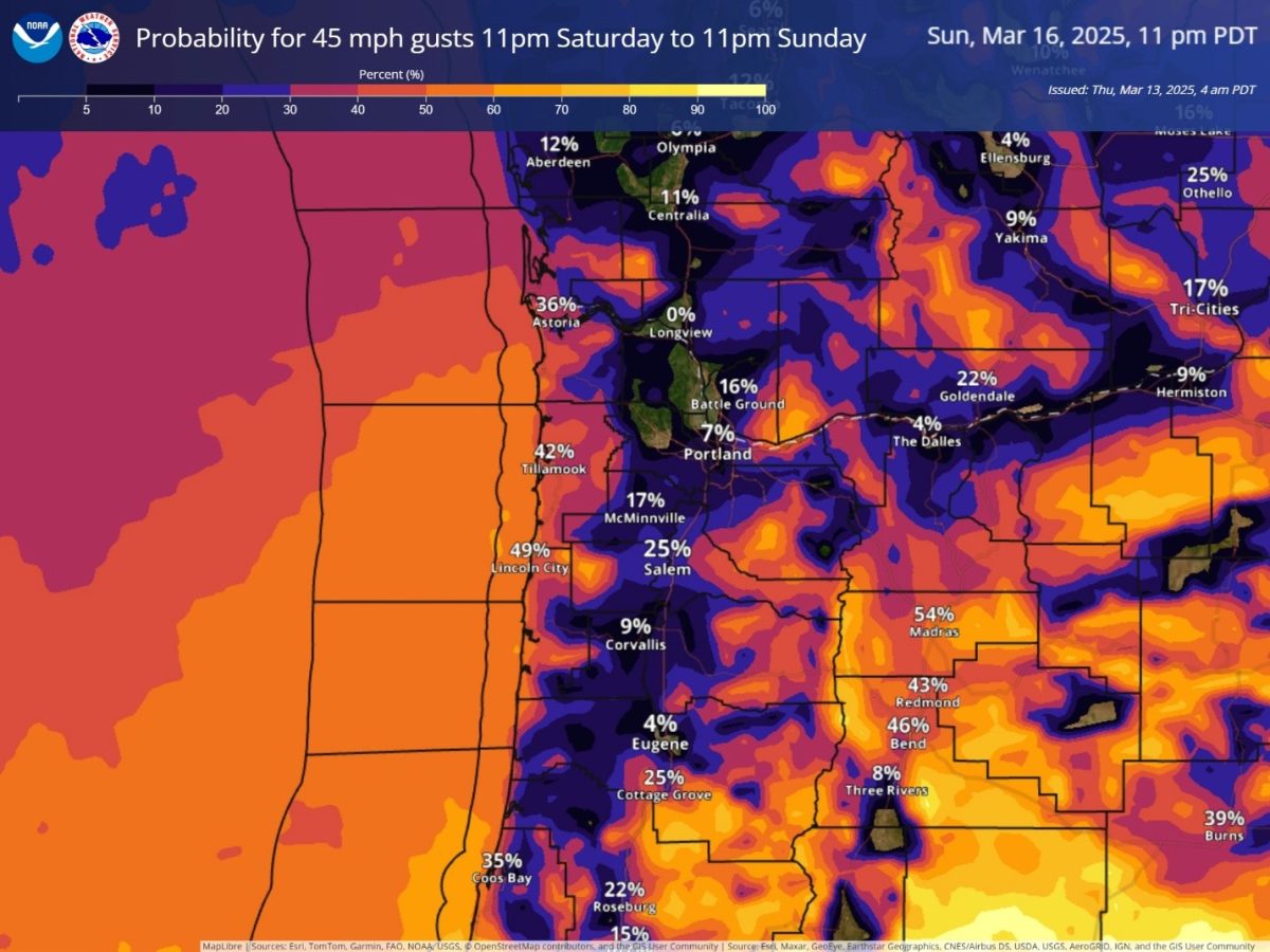
Now, let’s talk wind and rivers, I do expect the flow rates to increase with all this rain but any flooding potential currently remains at less than a 10% chance, but does bare watching over the weekend, just in case things change. Now as for the winds, there is some uncertainty in the exact path of a low pressure area off the coast that is driving the winds. Should it track closer, then we see increased winds of maybe 55 at the beaches and 45 inland, further offshore would give us decreased winds.
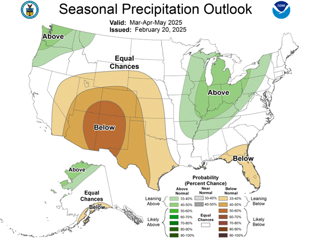
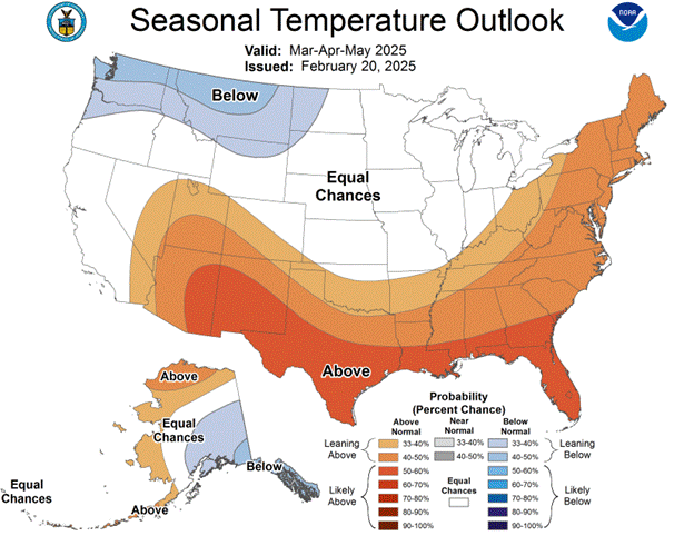
Hopefully Mother Nature will read the memo soon, that spring is just around the corner, like officially on March 20th. But, the long range forecasts suggest wet and cool for the next couple of months.
So, that’s it for now yall, until Monday, I hope everyone has a safe weekend.