By Gordon McCraw, Meteorologist for the Tillamook County Pioneer
There was some patchy dense fog around this morning as high pressure was building in over the area. And with the relatively clear skies, aside from the stratus that formed as the fog lifted some, combining with the light east winds, the low temperature dropped down to 32 degrees this morning.
It looks like that ridge will dominate the pattern for the next few days so look for mostly clear skies tonight, and with the calm winds, the low again drops down to around 33 degrees. If you need to go over the hill into the valley, know that they are, again, looking at low clouds and colder temperatures during the day and nighttime hours for a couple day, just as they experienced last week.
Tomorrow should be a repeat of today with partly cloudy skies and light easterly winds, the high near 54, then more stratus clouds tomorrow night with light southeasterly winds, lows near 37.
By Wednesday, the ridge weakens ahead of the next approaching weather system, and drifts eastward, so we see the partly sunny skies with southeasterly winds 4-8, the afternoon high near 55. We pick up a slight, but increasing, chance of rain under mostly cloudy skies that evening, with rain likely later Wednesday night, lows near 41.
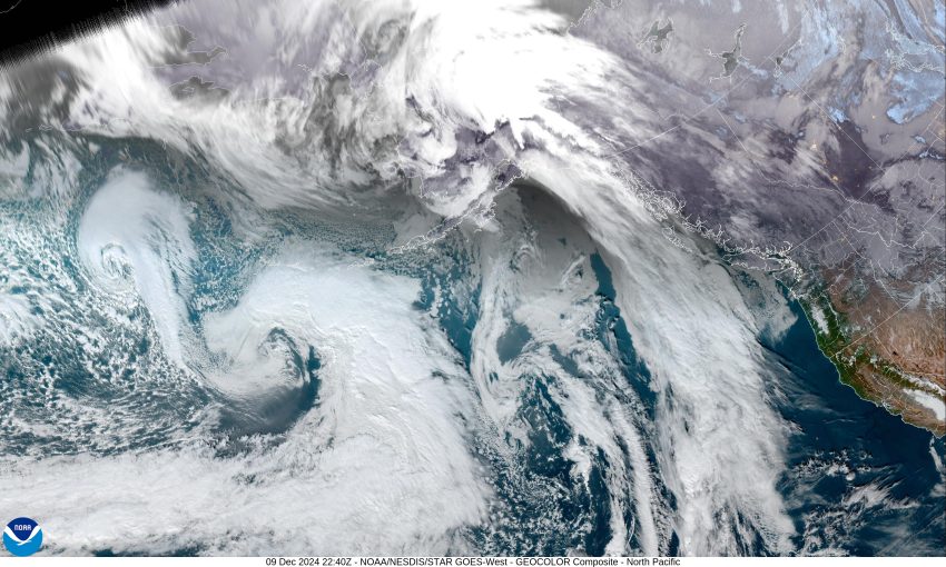
Here is where things get a little harder to pinpoint. The models are showing a low pressure area developing at the base of the trough, somewhere west of northern California, that appears to move east into northern California later Wednesday into Thursday as the associated trough drifts east over our area, bringing us more light rain Thursday and Friday, highs near 52, lows near 40.
Now, the “pinpoint” part moves in for the weekend. At issue is that low pressure area that is moving into northern California or southern Oregon around this time. It is always hard, especially this far out, to know for sure the exact timing, path, and strength of this low pressure area. As such, we can plan on more clouds and light rain over the weekend, and potentially, some breezy southerly winds for a brief period around Saturday afternoon, potentially 14-18 gusting to 25 in town with gusts to 40 at the beaches. The temperatures should continue in the low 50s with the lows down near 40 degrees.
Finally, you may or may not have seen that the Alaskan Aleutian Islands started having a swarm of some moderate to strong earthquakes yesterday, that continued today. The good news is that there were no reports of damage in that area with no injuries reported. There were at least 9 quakes of magnitude 5.0 and three at or above 6.0, the strongest of which was 6.3. The Alaskan Earthquake and Tsunami Center reports that swarms of quakes in this region of the Aleutians are common and are not necessarily a warning of anything more substantial. This brings heightened concern in Oregon because of the 9.2 earthquake Alaska, known as the Great Alaskan Earthquake that occurred on Good Friday, 1964, that generated a tsunami that reached Oregon, causing some damage and killing several people in the state. It should also be noted that the Alaskan earthquake fault zone is a different fault zone, not part of the Cascadia Subduction Zone off of Oregon. Had the Alaskan earthquake generated a tsunami, our area would have had 4 to 4 ½ hours before the wave strikes Oregon.
So, what does all this mean? Well, it means that coastal Oregon lies in the infamous Ring of Fire, and there are several fault zones across the state that can give us damaging earthquakes, and of course, we are under the threat of, The Big One (Cascadia Subduction Zone). All of this should equal a desire to become more prepared for a disaster. I remind you to think back to Hurricane Katrina, or more recently, the hurricane that did so much damage to the east coast. How long did it take FEMA to respond, and how was their response? Do you have a Plan, an Emergency Supply Kit, a Communication Plan, and have you practiced and discussed the plan with every member of your family? Now is a great time to start!
Watch the Pioneer for more emergency preparedness information so you can “Be Prepared, Not Scared.”


.png)
 (1).png)