
By Gordon McCraw, Meteorologist for the Tillamook County Pioneer
I saw a line on social media yesterday that is appropriate for this week’s weather, “it looks like spring will spring the next couple of days!” There were a few showers this morning from a disturbance that has been pushed northward today as high pressure builds in. This gave us warming temperatures today with a little more sunshine this evening. With the ridge, the calm winds, and the residual moisture, there is that chance of patchy fog later tonight, the low only dropping to near 48.
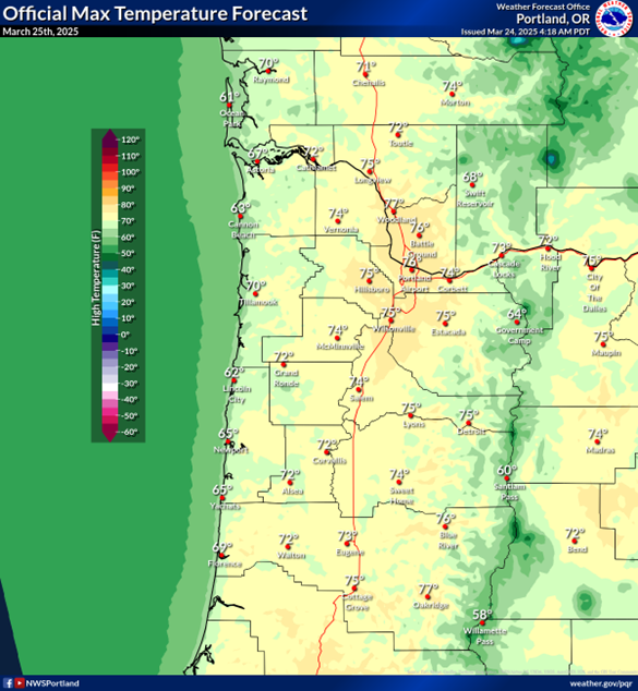
Tomorrow is the full-blown spring day — we can expect partly to mostly sunny skies with that ridge building in even stronger. The calm winds continue after the patchy morning fog clears, the afternoon high climbs to around 70. Over in the valley, they are looking at temperatures in the mid 70s with a slight chance it could even push up to near 80 in spots, leading to record high temperatures for some. Some clouds start to move in tomorrow night, still the calm winds, lows near 51.
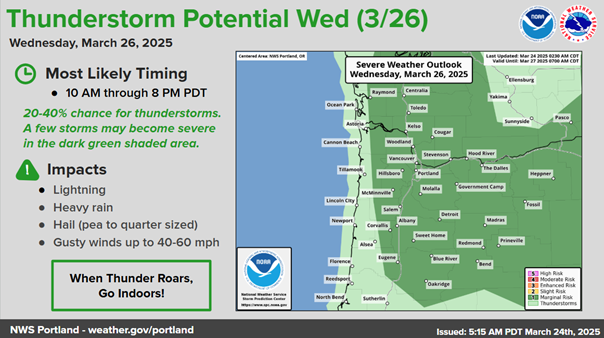
Wednesday, we see a stronger southerly flow develop along the coast, thanks to a trough sliding in from the southwest that is also pushing in some showers. Then throw in a slight chance of some increasingly unstable conditions, and stronger showers are possible with a slight chance of thunderstorms by around noon Wednesday, especially in the Coast Range eastward. Of note too is the fact that the Storm Prediction Center is giving the valley a 20-40% chance of seeing severe thunderstorms from 10am through 8pm Wednesday. As always, this is subject to change in futures weather models. The National Weather Service Portland put the chances at around 15-20%. We are also looking at breezy southerly winds 5-10 gusting to 25, the high only up near 63. More showers are expected Wednesday night, still breezy, lows near 44.
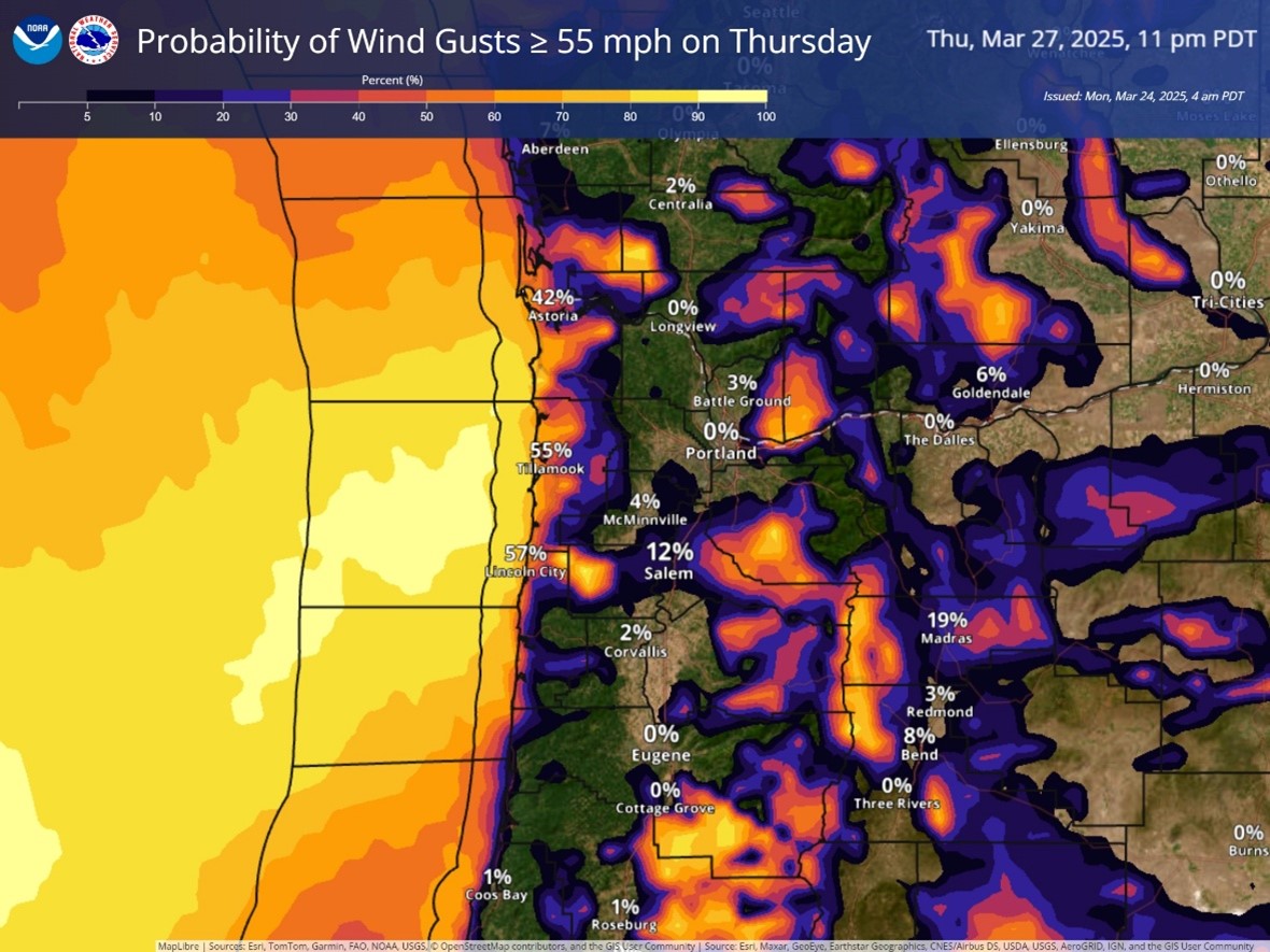
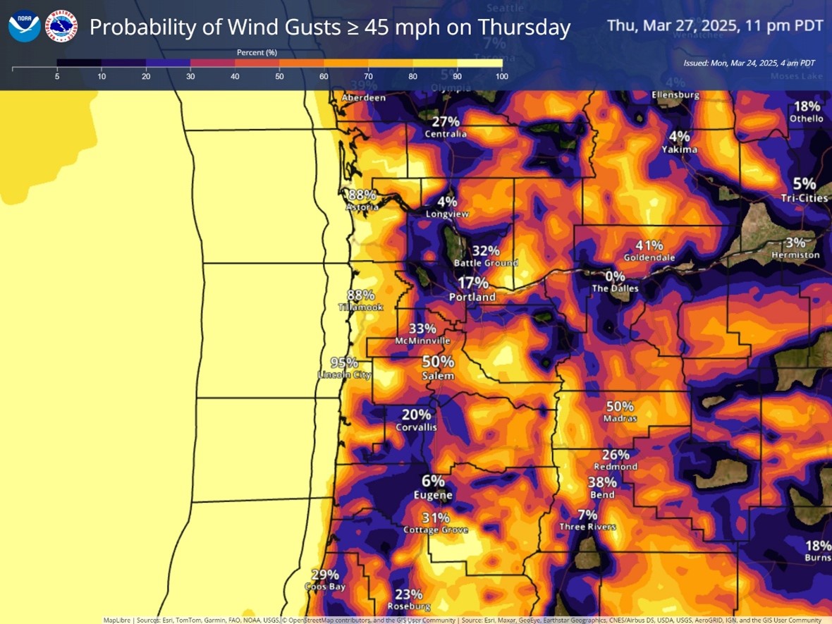
The trough continues to influence our weather on Thursday, along with a low pressure area sliding up the coast, so we can expect more showers with breezy southerly winds 14-18 gusting to 30, gusting to near 45 at the beaches with a 50/50 chance of gusts to over 55 there along the beaches, especially with the stronger showers as they race across. The winds do start to ease Thursday night with gusts only to near 20 by the early morning hours. High temperature Thursday near 52, lows near 43.
The trough continues to trigger showers on Friday, the low pressure now off the coast of Vancouver Island, so still some breezy southwesterly winds gusting to near 20, the high near 51, the showers become more scattered Friday night as the low weakens, the winds continue to weaken also, lows near 40.
It looks like we still have a chance of scattered showers over the weekend under mostly cloudy skies, afternoon highs remain in the mid 50s, lows in the low 40s.