By Gordon McCraw, Meteorologist for the Tillamook County Pioneer
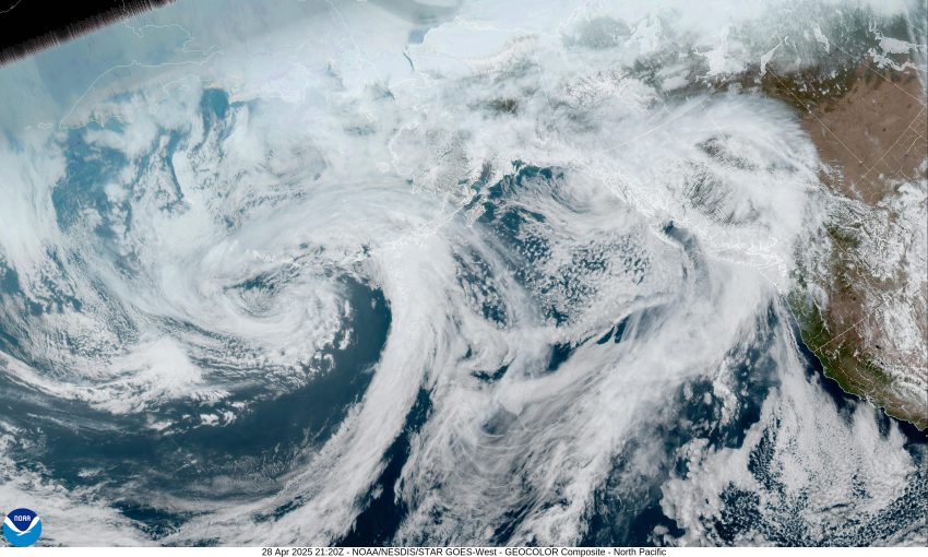
And here we are in the last few days of April Tillamook. This morning, we saw a weak ridge of high pressure pushing through that, when combined with the onshore flow, continued to give us some cloudy skies. This afternoon we had a disturbance move across in the flow that gave us a slight chance of showers. Now tonight, we have a weak front moving in that will bring some rain starting in the early morning hours, with calm winds, the low only falling to near 46.
The rain continues tomorrow morning as the front moves through, then the rain tapers off and diminishes in the afternoon. The winds tomorrow becoming westerly 4-8 in the afternoon with the high temperature near 58. The rainfall totals for this event is likely less than ¼”. Now tomorrow night we have another weak ridge moving in and building over the area, bringing us some partly cloudy skies and calm winds, the overnight low down near 38.
The nice weather returns Wednesday as the ridge continues to build over the region, bringing us sunny skies with light northerly winds, the afternoon high up near 62, and even with the mostly clear night, the lows only drop to near 42.
Thursday looks to be the warmest day this week thanks to that ridge of high pressure moving over the area, with sunny skies, the afternoon high here climbing to near 67 with the valley possibly get up to near 80 Thursday afternoon. So, the ridge looks to continue pushing off to the east ahead of the next weather system that brings us a slight chance of rain late Thursday night, the low down near 44.
Unfortunately, the cooler wetter weather returns Friday, so we can expect some mostly cloudy to cloudy skies with the rain likely by the afternoon that continues through Friday night, highs near 59, lows near 42.
More rain is likely Saturday with a chance of rain still on Sunday, highs near 57, lows near 40. The long range models suggest another ridge will build in for the start of next week.
So, I took a quick look at the Long Range Forecast from the Climate Prediction Center that was issued yesterday, for the period of May 8th through the 14th, which suggested the area will see slightly above average precipitation for that period, with near normal temperatures. So, what is near normal for May, well, the typical highs for May in Tillamook are around 57 to 68 degrees, the average lows 40-47, and the average precipitation in May is about 4.72”.
And there you have it Tillamook, until next month, this is meteorologist Gordon McCraw wishing you all have a great week.


.gif)