By Gordon McCraw, Meteorologist for the Tillamook County Pioneer
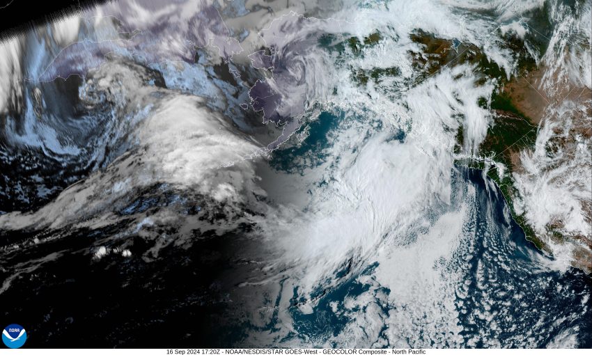
While we had a ridge of high pressure to our north today, there was a low pressure center over northern California that wrapped moisture around the east side of the rotation, pushing this moisture northwestward across the region. This did push a few clouds across the area today but with our northwesterly flow at the surface, this kept the high temperatures here in the upper 60s. For tonight though, we see a frontal system to the northwest that is expected to push this low pressure area in California to the northeast into Idaho, as it starts to push some clouds into our area. We can still expect the winds to diminish tonight so some patchy early morning fog is possible, the low dropping to near 51.
We see an increasing chance of rain starting in the early morning hours tomorrow as the front continues to approach from the northwest, making rain likely by around sunrise. The winds will become southwesterly 5-10 by the afternoon, the high only up to near 61. The front finally pushes through around midnight leaving some postfrontal showers, the winds again diminish in the evening, the low down near 53. As far as how much rain to expect from this system, it is looking like somewhere between ¼” to ¾” of rain can be expected.
We see more widely scattered showers on Wednesday under partly sunny skies, the winds becoming westerly 4-8, highs near 65. Any remaining spotty showers diminish by the evening Wednesday and we start to see high pressure building in, the usual patchy early morning fog is possible with the calm winds, the low dropping to near 51.
Thursday the high pressure continues so we expect partly sunny skies after the morning fog clears, the winds becoming northwesterly 5-10, highs still near 65, mostly cloudy skies that night, calm winds so patchy fog is again possible in the early morning hours, lows down near 49.
Just to make forecasting a little harder, Friday the models are now starting to get mixed, some are suggesting the ridge will continue over the area, bringing warm and dry weather for the weekend, but now the other half are showing a weak trough of low pressure sliding across the ridge that would give us a chance of showers starting later Friday night, through Saturday with a slight chance still on Sunday. With all the weekend activities planned, we will have to keep an eye out to see which of these two scenarios wins. The high temperatures during this period are around 66 degrees, lows around 49.
Just a heads up, the Autumn equinox is Sunday morning, September 22nd. We can welcome fall and continue to see shorter days, cooling temperatures with increasing weather.
And just a heads up for those that Follow me on Facebook. Someone that I did not know posted pictures on my Instagram feed that are against Meta’s rules and policies. As a result, they have suspended both my Instagram and Facebook accounts. I have appealed their decision and now wait to see the result, keep your fingers crossed.


