EDITOR’S NOTE: As more and more folks are venturing into the great outback, here’s an article to bookmark. Hiking enthusiast Don Backman reviews the top hiking apps and navigation tools, as well as sharing advice about having backups (cell phone batteries die), screenshots, and paper maps of the areas you are exploring. After the Sheriff Office Search & Rescue overnight Friday, this seems like a good resource for everyone to have on hand. See the end of the article for more links to Don’s hiking articles.
 By Don Backman
It was getting dark. My watch said there was still an hour to sundown but a thick fog had suddenly settled in among the tree trunks and underbrush, dimming the light noticeably. It was time to go. A buddy and I were archery hunting up in No Name Creek in Nunya Valley. No Name Creek is best accessed on “I Ain’t Telling” road. It’s the third left turn. Or was it the third right turn? This may have been somewhere in or around Gods Valley in the mid-to-late 1990s. Possibly.
We had driven up after work, hiked in, set up, and attempted to call in a nice bull. Nothing was happening and we both had to work in the morning, so the decision to head back was easy. The first part of the return route went pretty well as it followed a well-used elk trail. However, we had to leave the trail to work our way back up a ridge to catch a faint connecting trail over to where we were parked. The whole thing was an easy 20 to 30 minute hike out, one we had done before, only this time it wasn’t that easy.
The higher we climbed, the thicker the fog became. Soon, it was so thick, dark, and spooky that we could barely see the trees around us. At that point, it was impossible to tell which way we needed to go. We stopped and I dug out my Garmin GPS unit (GPS 12XL) and took a break while it searched for satellites, which took a while because the trees around us were essentially tall towers of signal blocking water. Once it locked, it was a simple matter to find the waypoint where the truck was parked and then use the GPS to navigate our way back. We were off course, but not by much. Without the GPS, we would have wound up in a thick mess of pre-commercial thinning. While we would have gotten out eventually, it would have taken a lot longer in the extremely poor visibility, even with flashlights. Backtrack just a few years to a time before GPS and we would have had a very long night.
Navigation tools for hikers and hunters have changed dramatically in recent years. In the 1990s affordable GPS units were known for not being able to find satellites from within timber and the bottom of canyons. Only the really expensive ones had any rudimentary mapping capabilities, and mine didn’t. We just had an arrow to follow and a compass direction, which meant also using a separate compass as the unit’s electronic compass couldn’t update fast enough for foot travel.
I no longer use a dedicated GPS regularly. Mike, my hiking buddy, has a relatively new, very nice (expensive) unit that is light-years more advanced than the ancient model I used back in the ’90s, yet most times he doesn’t need to use it. Our cell phones and navigation apps meet our needs. Last October we hiked the loop around the Three Sisters. This took two nights and most of three days. That was my first time hiking that area and I carried a map and compass that never came out of the pack, relying the whole way on a Samsung cell phone with GaiaGPS. Mike’s GPS also stayed in his pack.
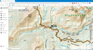
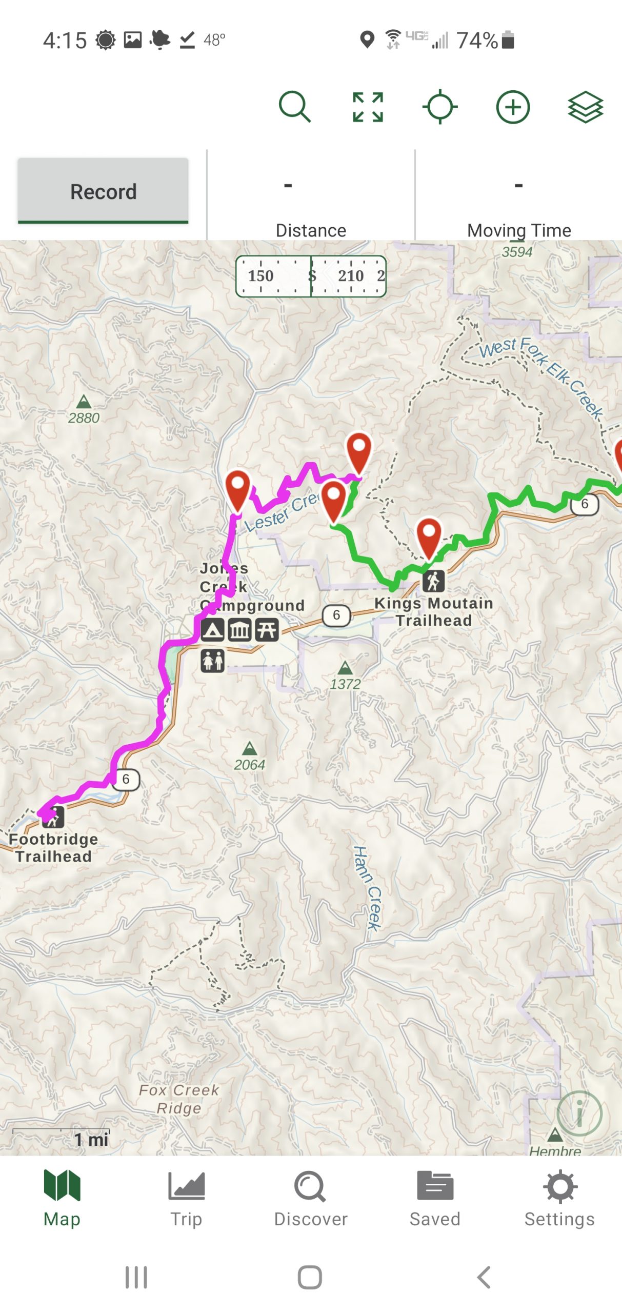
It was a simple matter to pull out the phone at trail junctions, open GaiaGPS, and check the map and our location in one easy step to see if we were on the right trail. It worked well. We used the phones to find water sources and measure our progress to camping areas, too. Mike ran both Gaia and Strava as he wanted to track our pacing in Strava on his iPhone which was very useful to know. It helps to be able to predict when or if you’ll reach a water source or camping area, for example. Granted, there is a well-established trail system in that area, and it is signed, but the phones performed very well.
I currently use a paid version of GaiaGPS, a paid version of OnX Backcountry, and free version of Avenza. If I want to track my hiking pace I’ll use MapMyRun which seems to use less power on my Samsung. There are other apps but I haven’t tried them. These particular apps are well-reviewed and GaiaGPS is commonly referred to as the best backpacking app available. OnX is a close second. At home on my laptop, I use Gaia predominantly and occasionally use Google Earth, USGS Topographic Maps (online), and Cal Topo as needed for research and planning.
This sounds like a big list, but GaiaGPS does the heavy lifting. The paid version of GaiaGPS allows you to download a wide variety of map layers to your phone in advance for offline use so you don’t need cell service to use them. GaiaGPS also allows for creating a route in advance or downloading a route someone else has already created, so all you need to do is follow it. It has overlays for private land and public land, which are helpful. However, private land ownership can and does change faster than maps are updated so keep that in mind.
Currently, in and around Tillamook County, I keep the GaiaGPS map active and often will use the Outdoor map and the Satellite map with labels, activate them when needed, and then close them to save battery. The USGS map can be helpful, as can the private and public and overlays. When I’m hiking on Forest Service land I’ll use the USFS roads and trails map, too. Gaia’s maps are a bit weaker in the State Forest so Avenza is useful here.
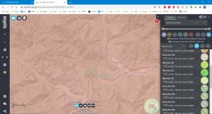
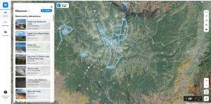
OnX Backcountry is a relatively new player in the hiking arena, but OnX has been around with other apps for quite a while. They absorbed the Outdoor Project which means that have a lot of useful hiking related information about numerous trails and locations. On a recent trip to the Strawberry Mountain Wilderness, we found ourselves being the first hikers this year on a segment of trail that was completely obscured by thick Manzanita bush. We ended up with one person using Gaia, and the other using OnX as we were doing route finding. This was a great combination and we were able to navigate through the area. This highlights the fact that while the apps are good, no one app does it all – yet. However, in my mind GaiaGPS gets the nod as the best app at this time.
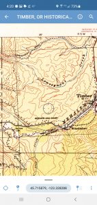
Avenza is another App that I use occasionally. The free version allows users to download a substantial collection of free local road maps for the highways and forests in Tillamook, Clatsop, and Lincoln counties. Also, it currently allows you to import GPS-enabled PDF maps, and the first three you download will work with the GPS function. It will locate you on the map and even track your movements down a road. For example, I have the Oregon Department of Forestry Northwest Oregon Fire Protection Maps (North and South) with virtually every road in the Tillamook, Clatsop, Columbia, and Washington counties on my phone. This came in handy on a recent hike to Giveout Mountain.
Giveout Mountain is in Eastern Tillamook County across the Port of Tillamook Bay railroad over by Timber. You can’t get there from here, so this is an area I haven’t explored much. You have to drive around the long way. It’s convenient for my hiking buddy and me because it is roughly halfway in between our homes.
We were hiking near the peak in knee-deep snow. Mike had gone ahead because I was lollygagging along taking photos and recording video. The route I had planned in GaiaGPS turned to the left at a junction. It didn’t seem right, but Mike’s tracks went that way, so I followed. It wasn’t long when I met him coming back. He had reached the same conclusion. We conferred and eventually went up that same road to where there was a landing and we could see the countryside. The road continued but looked sketchy like it was going to a dead end.
GaiaGPS showed that we were on the planned route. Avenza located us on the ODF map where we could see how the roads were interconnected. There was another, more direct route (the ODF maps had been updated in 2019). We backtracked to the junction, then hiked down the other road to another intersection where we were once again on the Gaia track. We had just cut off a large switchback. I like having the road maps in an app that uses GPS. It takes the guesswork out of it. This illustrates that with anything map-related it is best to cross-reference with a known accurate map.
A new feature in GaiaGPS is the 3-D view on a computer or home device. This is handy for looking at the terrain while planning a route. It doesn’t replace knowing how to read a topographical map in the field, but it helps get an overall mental image of the terrain for planning alternate routes. One could also use Google Earth to do the same thing, but it is simpler to do it all in the same app.
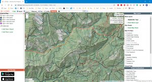
I also use other apps and websites to plan hikes. We went looking for an old, burned-out railroad logging camp from a forest fire in 1932. This one is marked by trees growing through old mattress springs. The free USGS quad maps from the 1940s that show the old railroad grades have been super helpful. I’ve downloaded them onto the phone and look at them out in the field. Also, the CalTopo website allows you to access many different mapping layers and build a custom track to follow similar to Gaia. Google Map and Google Earth’s satellite imagery can also be useful.
My usual workflow when planning a hike that isn’t following a set trail system is to look the area over in GaiaGPS on my laptop, possibly using several layers, and develop a route. Then, I like to download the map info for the area – satellite images, USGS maps, and any other maps that apply – to the phone ahead of time so cell service isn’t needed. I can also refer to online sites such as Forest Hiker, Oregon Hikers, Hike Oregon, All Trails, etc…, where we can read reports, watch videos, and download GPS routes other people may have created.
How good are cell phone GPS capabilities? Currently, we can almost match Mike’s dedicated GPS unit. Plus, we can download maps and GPS tracks as needed, and use photos and text reports. Modern phones and GPS units often use more than one GPS satellite network, too. There are several, such as Russia’s GLONASS system, the European Galileo system, or China’s BeiDou system. This appears to help both location and areas covered. So far we have always had good satellite connections, even on a dark winter’s day down in the bottom of Gales Creek where we could barely see the sky. This is far better than any dedicated GPS unit I have ever used. My GPS unit would have been useless weight.
As with any electronic tool, one needs to be aware of potential issues. Mainstream online mapping services such as Google Maps often have errors when you get off highways, especially with road and creek names. While I rely on Google Maps to get me to the trailhead or highway turn-off, I choose not to use it for anything beyond that point. Gaia, OnX BackCountry, and Avenza are as good as the maps we load them with.
Cell phones and GPS devices do have an Achilles Heel. The big screens require a lot of power, and running GPS tracking apps on phones eats that power quickly. For that reason, I prefer to not use the tracking capabilities in Gaia or Avenza unless necessary. It only takes a few moments to open the app and have it find my location on the map, then shut it down when done. On longer hikes or overnighters, one can use airplane mode so the phone isn’t using power looking for cell coverage. Closing down every unnecessary app and limiting screen time also helps, as does using low battery mode. On a day hike, I carry a small battery pack. On a longer trip, I use a larger one that supports quick charging and can charge the phone five or six times over. On shorter hikes, I usually don’t use airplane mode as my battery lasts long enough.
Another potential downfall is app overload. It’s possible to have too many apps running. Generally, I’ll only use one, which is GaiaGPS and will open another one only to check something, such as the ODF road maps in Avenza, then shut the app down. I accidentally had GaiaGPS and Avenza each tracking my route at the same time and was recording video occasionally, too. They ate up the battery pretty quickly. I believe it is best to shut down everything that isn’t needed.
A notable addition is What3Words. The entire world has been divided up into three-meter squares, each identified by a unique combination of words. The idea is that it is easier to tell someone your coordinates by using three words rather than trying to find the exact GPS coordinates. For example, these coordinates are taken from the What3Apps website: 51.520847, -0.19552100. The three words are filled.count.soap. The words have no meaning and were originally assigned randomly to the map. The numbers are the GPS coordinates. Words like filled.count.soap are much easier to remember and share in text or on the phone than a long string of numbers. It is still new, and support among emergency services might be spotty. It’s handy though to be able to send a text to your partner with your exact coordinates if you get split up (and have cell service).
Another option is to put a GPS app on your phone, too. These allow you to use your phone as a regular GPS. I have one but rarely ever use it. It’s there for emergencies but is nice to have, was free, and could turn out to be handy at some point.
Cell phones and GPS units are useful devices. However, they are fragile and can break or fail, so it is still good to have map and compass skills. Keep in mind that Lithium-Ion batteries don’t do well in cold, so it is especially important to have backup power for really cold hikes. It is also a good idea to keep your phone and battery pack warm with body heat in an inner pocket.
I mentioned carrying a map and compass on the Three Sisters loop last summer. That is a good backup plan. I won’t go into details on how to use a map and compass because that would be a whole different article. There are many instructional videos on YouTube and businesses such as REI offer classes. It is a good skill to have.
There are a host of apps for hiking. I haven’t used them all so can’t speak about their usefulness. Every app has its strengths and weaknesses. REI and Clever Hiker have good articles on apps. Check out the links included in this article. They will take you to the apps and sites I’ve found useful.
The established hiking trails in the state parks along the coast, and the forest trails developed by ODF and USFS, all have been established for a while and are available online. You can usually find a map at the trailhead to snap a quick picture of. However, if you go off-trail or plan your own routes, such as Giveout Mountain mentioned earlier, then mapping capabilities become important.
How did we ever manage without smartphones? Very well, thank you. However, I wouldn’t go back to only using paper map navigation. While it is never a good idea to just rely on one device, cell phones are a very handy navigation tool in the backcountry. You can even listen to music, enjoy podcasts, read books, watch movies, and talk to people on them!
Links to hiking resources:
Oregon Hikers: https://www.oregonhikers.org/field_guide/Main_Page
Forest Hiker: http://www.foresthiker.com/
Gaia GPS: https://www.gaiagps.com/
Avenza: https://www.avenzamaps.com/
CalTopo: https://caltopo.com/
USGS quad maps: https://apps.nationalmap.gov/
ODF Protection from Fire maps: https://gisapps.odf.oregon.gov/ProtectionMapDownload/
Topo View: https://ngmdb.usgs.gov/topoview/viewer/#4/40.01/-100.02
What3Words: https://what3words.com/
OnX Backcountry: https://www.onxmaps.com/backcountry/app
YouTube can be a great resource – check out Don’s YouTube channel – Outback with Backman
Go to YouTube and search for your area of interest. There are often videos. Quality can vary considerably, so due diligence is needed.
Instruction and more information:
REI Map and Compass course – https://www.rei.com/events/162/introduction-to-map-compass-navigation-class
REI: https://www.rei.com/blog/hike/the-8-best-hiking-apps-you-need-to-download-now
Clever Hiker: https://www.cleverhiker.com/blog/how-to-use-your-phone-as-a-gps-device-for-backpacking
Tillamook County recreation map: https://tillamookcoast.com/recreation-map/

.png)