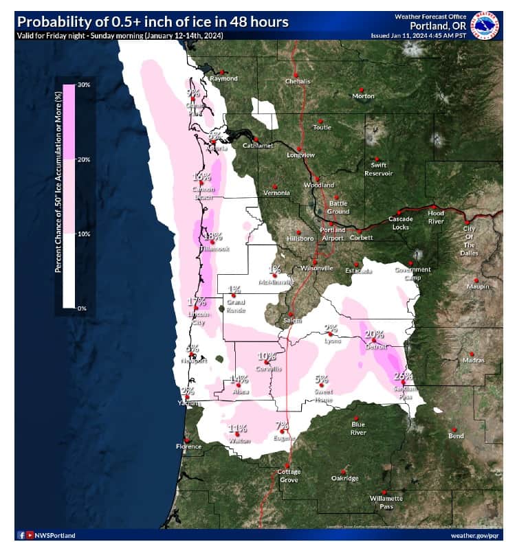
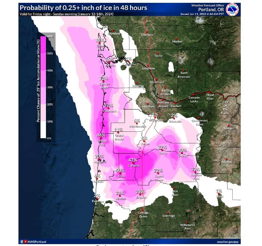
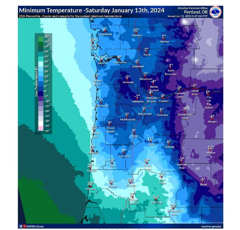
Starting late Friday afternoon, January 12th, freezing rain is forecast along the coast with .1” to .25” is predicted. There is potential for up to .5” south of the City of Tillamook. Low temps could be as low as 10 degrees through Sunday, with highs reaching around 35 degrees. Winds may gust up to 30 mph. This will make the roads extremely treacherous for travel.
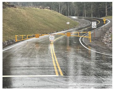
The county Department of Emergency Management urges residents to limit their travel this weekend due to possible ice storms and deteriorating driving conditions. Public Works will be closing the new alignment portion of the Cape Meares Loop road this afternoon January 11, due to the possible inclement weather and will re-open when weather permits.
Be sure to monitor local weather forecasts, if you have to travel be sure to check www.tripcheck.com as hazardous winter weather is forecast for the entire region.
Here is the current timeline for our upcoming winter storm across northwest Oregon and southwest Washington. 
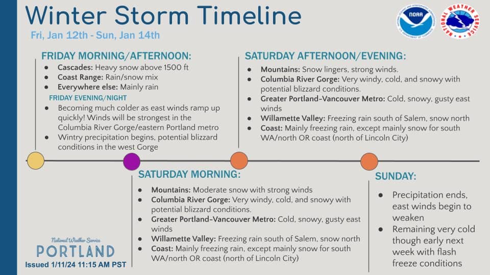
Lowland Snow & Freezing Rain Fri-Sat; Cascades snow Thu-Sat; Cold Temperatures Weekend – Early Next Week
KEY POINTS
• Coldest temperatures so far this season beginning Friday night (Jan 12) through at least Monday (Jan 15).
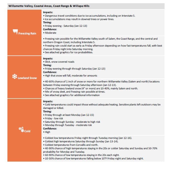
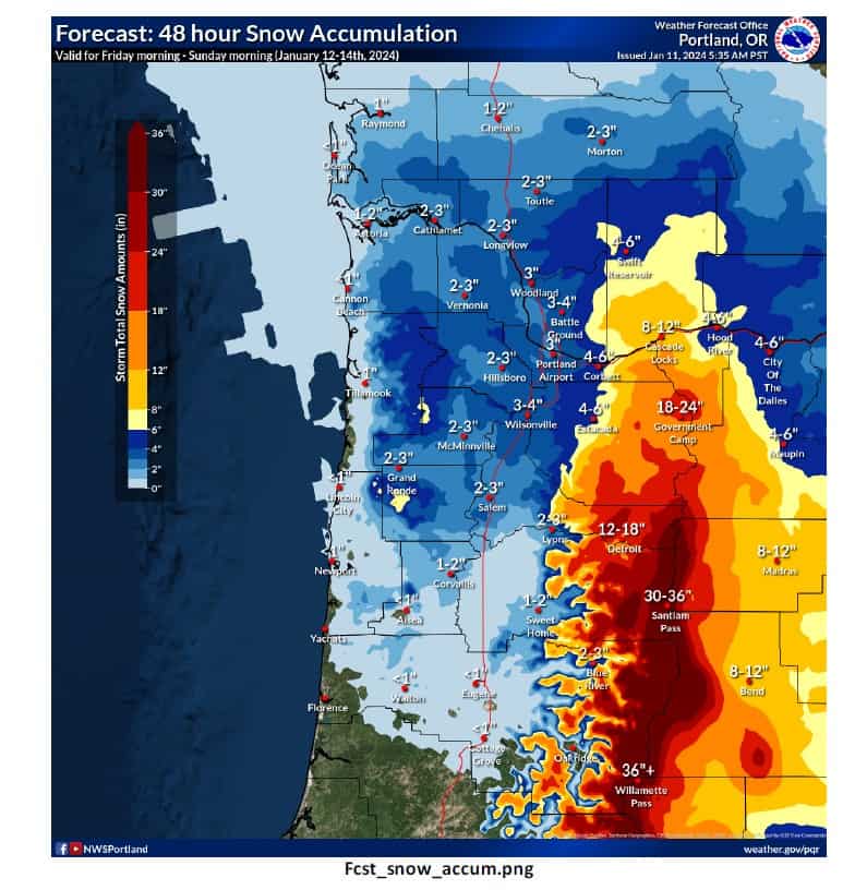
• Lowland snow possible for most locations below 1500 feet Friday into Saturday (Jan 12-13). Best chances for locations north of Corvallis/Albany, including the Portland/Vancouver metro, and Coastal Areas from Tillamook north.
• Freezing rain possible Friday into Saturday (Jan 12-13) for the Willamette Valley (not including the Portland/Vancouver Metro), Coast Range, and Oregon Coast, including Interstate 5.
• Strong east winds through the Columbia River Gorge along with lowland snow could cause blizzard conditions Friday into Saturday (Jan 12-13), including Interstate 84.
• Cascade snow continues Thursday into Saturday (Jan 11-13) with snow levels above 1500 feet.
CHANGES FROM PREVIOUS BRIEFING
• Adding freezing rain and snow for Willamette Valley, Coastal Areas, and Coast Range & Willapa Hills for Friday through Saturday (Jan 12-13).
• Increased snow risk to moderate on Friday (Jan 12) for all locations.
• Added wind to Cascades and Cascade Valleys & Foothills for Friday through Saturday (Jan 12-13).
• Removed Hazardous Seas and Gales for Coastal Waters on Thursday (Jan 11) because those impacts ended around briefing issuance.
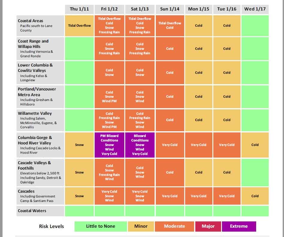
WEATHER RISK OUTLOOK
Risk levels incorporate potential impacts from weather hazards and likelihood of occurrence for a reasonable worse case scenario.
 This info can change, so be sure to stay updated with the latest forecast at weather.gov/portland
 Some preparedness actions to remember:
– Have emergency supplies for your home and car
– Check your smoke and carbon monoxide detectors
– Replenish fuel for your car/heating sources
– Adjust plans if necessary
– Have multiple ways to receive warnings
 For road conditions, visit:
– tripcheck.com or dial 511 (Oregon)
– wsdot.com/Travel/Real-time/Map/ (Washington)
![]()

![]() This info can change, so be sure to stay updated with the latest forecast at weather.gov/portland
This info can change, so be sure to stay updated with the latest forecast at weather.gov/portland![]() Some preparedness actions to remember:
Some preparedness actions to remember:![]() For road conditions, visit:
For road conditions, visit:


.png)