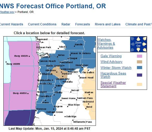
* WHAT…Significant icing expected. Total snow accumulations of up to one inch and ice accumulations of around four tenths of an inch.
* WHERE…Coast Range of Northwest Oregon and Central Coast Range of Western Oregon.
* WHEN…From 10 AM to 10 PM PST Tuesday.
* IMPACTS…Power outages and tree damage are likely due to the ice. Travel could be difficult.
* ADDITIONAL DETAILS…Significant icing is expected on the east side of the Coast Range for areas below 1000 to 1500 ft.
* AFFECTED AREAS: COAST RANGE OF NORTHWEST OREGON … CENTRAL COAST RANGE OF WESTERN OREGON
Instructions:
Travel is strongly discouraged. If you must travel, keep an extra flashlight, food and water in your vehicle in case of an emergency. Prepare for possible power outages. For the latest road conditions call 5 1 1, or visit for Oregon: https://www.tripcheck.com and for Washington: https://wsdot.com/travel/real-time/map
Severity: Extreme – Extraordinary threat to life or property
Urgency: Expected – Responsive action SHOULD be taken soon (within next hour)
Certainty: Likely (p > ~50%)
Category: MET: Meteorological (inc. flood)
Event Description: Ice Storm Warning


