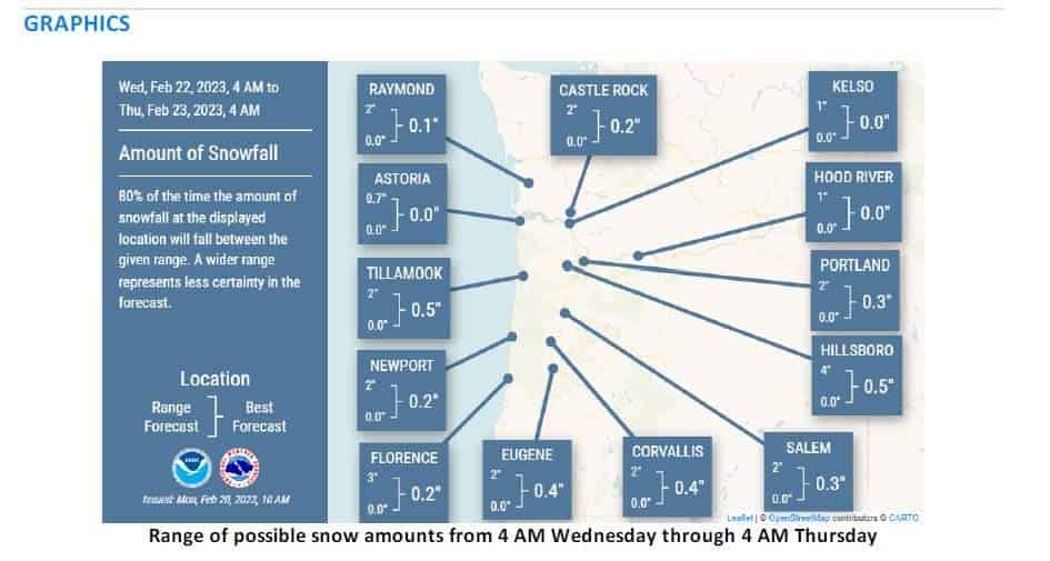
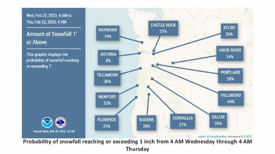
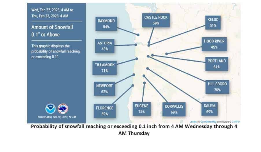
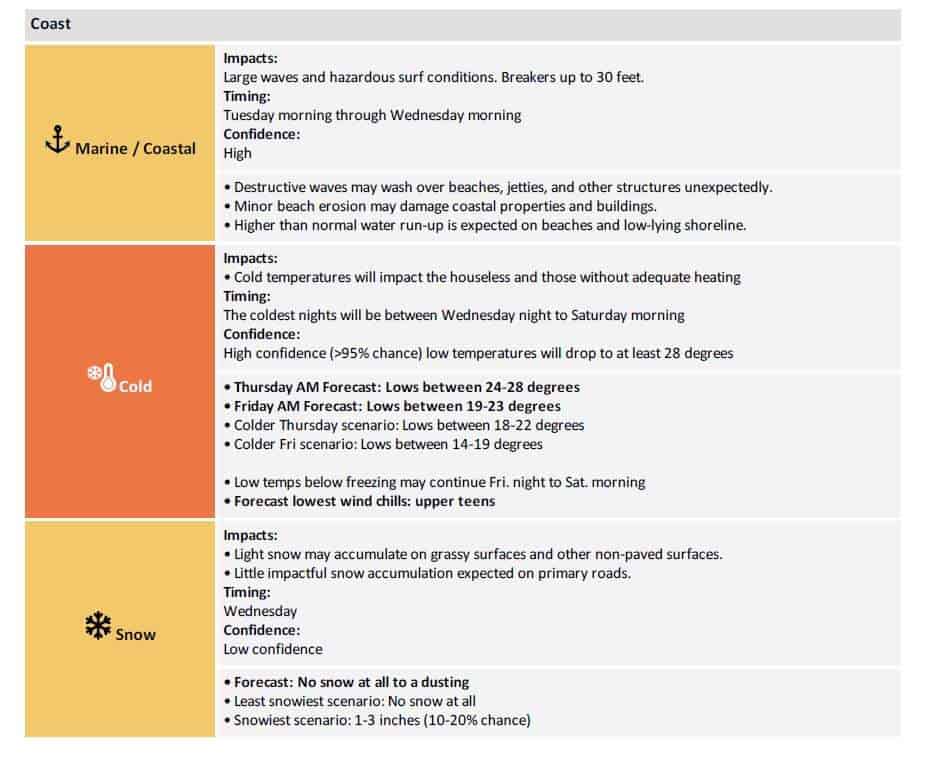
A strong jet stream aloft will amplify a low pressure system tonight (2/21/23) that will slide south along the British Columbia coastline and into the Pacific Northwest. Persistent, strong northwesterly winds will elevate seas across the coastal waters driving seas into the mid, possibly upper, 20 foot level as well as producing hazardous beach conditions with breakers up to 30 ft. As the upper level trough becomes more pronounced it will dig southwest and surface low will pull cold continental air west of the Cascades. Forecast confidence remains high (90% chance) that temperatures will become gradually colder Tuesday into Friday and remain cold through Saturday. Temperatures during this time will be cold enough to support lowland snow. However, confidence remains low when it comes to the exact snow amounts, location, and timing of the precipitation.
Meanwhile, confidence is high for impactful snowfall in the Cascades and Coast Range Tuesday through Wednesday where Winter Storm Warnings are currently in effect.
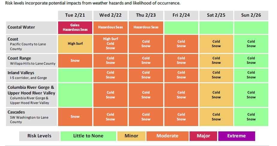
KEY POINTS
Building seas will produce hazardous marine [23 – 25 ft] and surf [30 ft breakers] conditions Tuesday into Wednesday.
High confidence (90% chance) we will experience colder temperatures across the region Tuesday to Saturday morning.
Coldest temperatures expected Wednesday night – Saturday morning, but east winds will make it feel colder.
There are chances for lowland snow this week, but forecast confidence remains low.
High confidence for impactful snowfall in the Cascades and Coast Range Tuesday – Wednesday.
