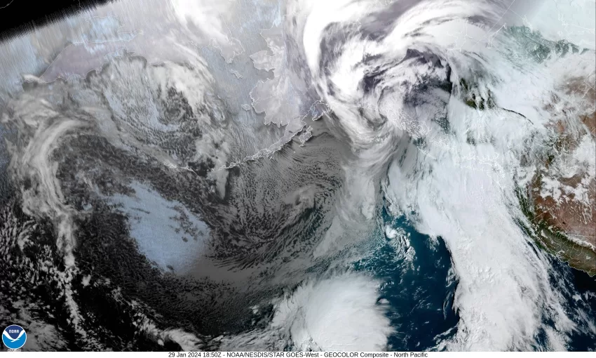
Tuesday, January 30, 2024 – Weather by Gordon McCraw
Another mild, muddy night where the temperature only dropped to near 52 at the airport with some spotty light rain. This morning we had a disturbance move up the coast in the upper level southwesterly flow which was the cause of the drizzle. It looks like another disturbance will ride up in the flow later today and brings another chance of light rain or drizzle to the coast and Coast Range with easterly winds 5-10, the afternoon high climbs back to around 60. Tonight, we see a stronger low pressure area moving eastward toward the coast that will rotate a front towards the coast and bring increasing winds. So, the rain moves in later tonight and the winds increase to southeasterly 10-15 gusting to 25 with higher gusts likely at the coast like usual, the overnight low again only drops to near 53.
The rain continues tomorrow with the breezy southeasterly winds 14-18 gusting to 25, the high near 57, the rain continues tonight until the front pushes though a few hours before midnight. Behind the front we see postfrontal showers, the winds southerly 8-12, and the low drops to near 48.
That low pressure area off the coast that pushed the front in will be lifting to the northeast by Thursday where it meanders west of Vancouver Island for a while. This will continue to rotate showers across our area, and continue to bring breezy southerly winds of 10-15 gusting to 20, the high only up to near 55. The showers and breezy winds continue Thursday night with the winds southerly 15-20 gusting to 25, the low down near 43.
Friday the low is still spinning west southern Vancouver Island but by this time, a trough of low pressure with cooler temperatures is rotating towards the area, under the low, so we see showers with breezy winds still, and the high only makes it to near 50. Friday night the shower activity continues then becomes more isolated by midnight, and we see the snow level starting to drop, falling to near 2600’, so we’ll see some snow in the higher Coast Range mountains again.
Saturday looks partly sunny with a chance of scattered showers, the high near 50 and the snow level around 2500’, then after the sun goes down, so do the temperatures, falling to an overnight low of near 37 degrees. This also pulls the snow level down to near 2200’.
Sunday, we have only a slight chance of showers still under mostly sunny skies, the snow level that dropped to near 2000’ just before sunup, climbs with daytime heating to near 2200’, the afternoon high near 51. Partly cloudy skies Sunday night with slight chance of a widely scattered light shower, the snow level around 2400’, the low down near 39.
So, here we are near the end of the first month of 2024, a month that has given us a wide variety of weather, from warm and muggy to cold and icy, and bringing some dry to very wet days. In case you are wondering what to expect for February, here is the Climate Prediction Center’s guestimate that shows we have a good chance of seeing above average temperatures for the month of February with an equal chance of above or below average precipitation in the Pacific Northwest. It looks like February will start out cool and wet though.


